
GIS Software for Civil Engineering & Construction
Make confident, cost-effective land decisions and collaborate across jurisdictions to focus on the highest-potential sites and move projects forward with precision.


Make Faster, Smarter Decisions
Why Civil Engineers & Construction Teams Rely on Latapult

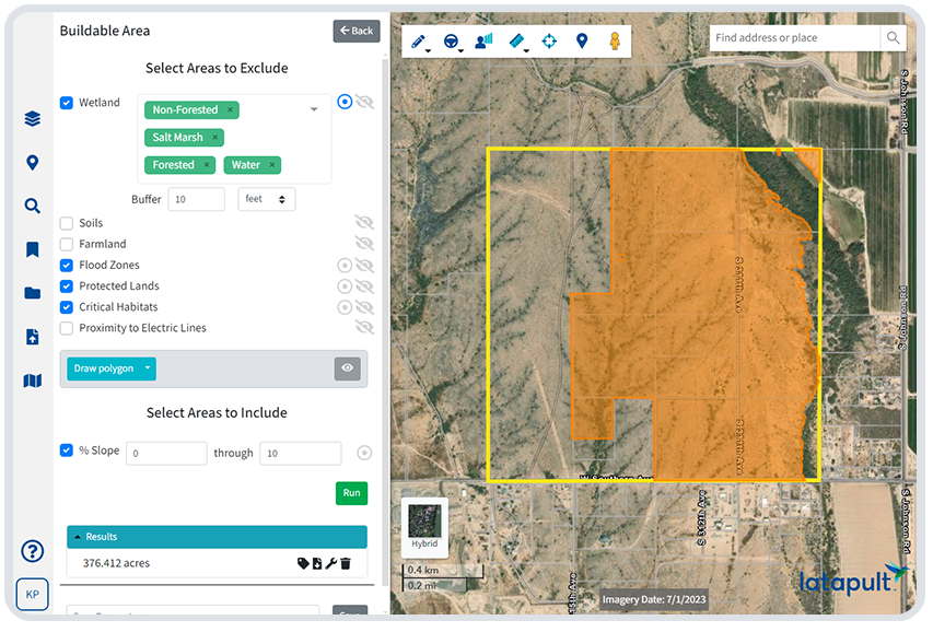
Perfect Plan Pre-Development
Evaluate zoning, slope, boundaries, and land constraints early so your plans are grounded in what's truly buildable.

Stay Connected Across Regions
Access county and municipal data from multiple areas in one place to coordinate planning across your full footprint.

Support Business Development
Win trust and build relationships with fast, visual intel that helps clients see exactly what you see.

Cut Time Wasted on Manual Search
Skip the disconnected tools and siloed layers. Latapult keeps everything in one platform, so you can move faster.

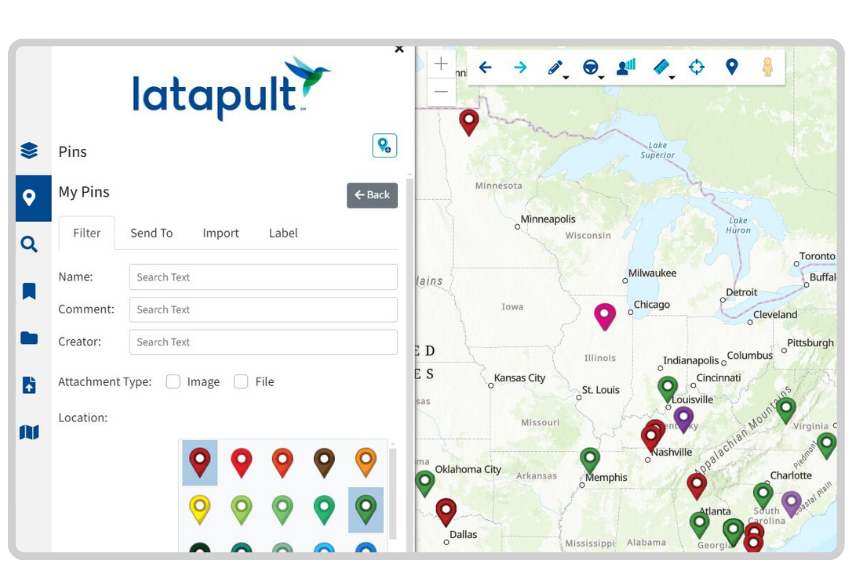
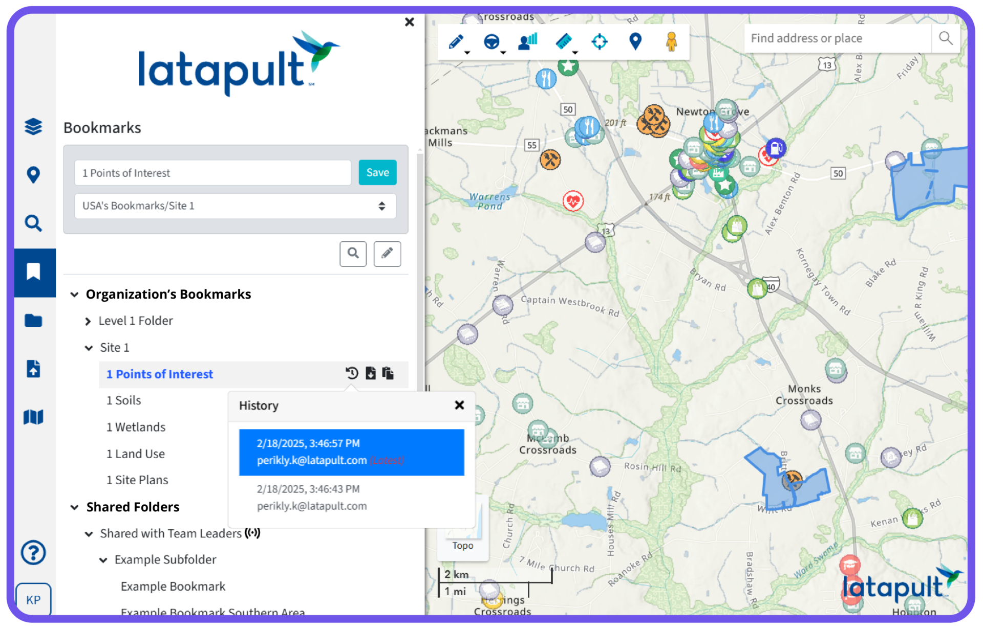
Curate and Share Insights Easily
Bookmark sites, drop pins, and share folders so teammates, partners, and clients stay on the same page.

Get Answers in the Field
Pull parcel details, ownership info, and site intel from anywhere, whether you're in the office, the truck, or on-site.
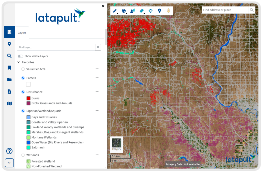
Get Visibility Into Every Variable
Bring Clarity to the Earliest Stages of Development
- Create and share pre-development scenarios across municipalities
- Access reliable data from multiple counties in one place
- Answer specific site questions fast with parcel-level accuracy
- Track topographic factors, zoning, and nearby infrastructure
- Share visual updates and insight with internal and external teams

GIS Land Data Layers Built for Civil Engineering & Construction Projects
Understand the full picture before you commit. With essential datasets that get you to the next phase of your project faster, including:
- Parcel Data – Analyze ownership, acreage, tax values, and transaction history
- Transaction Data – See sales volume, price per square foot, and other market signals
- Topography – View percent slope, USGS elevation, and terrain classification
- Economic Data – Identify Qualified Census Tracts, Opportunity Zones, and development incentives
- Census Data – Review population, income, and household demographics by location
- Transportation Data – Evaluate proximity to roads, railways, ports, and airports
We work with civil engineering and construction clients nationwide. Put your trust in experienced hands.
-
300+
Businesses nationwide
Supported in uncovering insights that transform projects.
-
50x
Faster land research
To justify, approve, and negotiate land deals quickly and strategically.
-
$1K+
In savings a month per user
On resources, labor, and more.
-
$1M+
In GIS data
Powering environmental, demographic, geospatial, and topographic insights.
GIS Tools That Bring Teams and Data Together
- Drop pins to mark and annotate potential sites
- Use bookmarks to track and group top candidates
- Apply the Buildable Area Tool to calculate usable land instantly
- Export maps to share with executives and partners
- Import external site plans or overlays
- Use filters to spot emerging zones before they’re widely recognized
Customize Latapult for Your Workflows
Some teams need more than a standard GIS setup. When that’s the case, our experts can tailor the Latapult platform to support your data, systems, and processes.
- Import and manage attribute-level data for project-specific needs
- Set up workflows to track project phases or internal reviews
- Integrate with external systems such as CRMs or databases
- Collaborate with a GIS expert to adapt Latapult to your workflow


Frequently Asked Questions
-
How is GIS used in construction?
GIS is used in construction to support better planning, coordination, and decision-making throughout a project’s lifecycle. From identifying optimal site locations to mapping utilities and infrastructure, GIS helps teams visualize land conditions, analyze risks, and streamline workflows. It also facilitates communication across teams by centralizing spatial data in a single, interactive system.
-
Do civil engineers use GIS?
Yes, civil engineers frequently use GIS to evaluate land, assess infrastructure needs, and support data-driven project planning. GIS helps engineers analyze terrain, utilities, water, and transportation data, giving them a clear picture of site viability and constraints before development begins.
-
What is GIS used for in planning?
GIS is used in planning to visualize land use, evaluate zoning impacts, study demographic trends, and support long-range infrastructure decisions. It helps planners make informed choices by layering data about the environment, transportation, and communities on a single map interface.
-
What are the uses of GIS in architecture?
GIS helps architects design in context. It’s used to study site constraints like topography or flood zones, plan sustainable building placement, and understand the relationship between a building and its surrounding environment. It also supports community engagement and approvals by providing visual, map-based presentations.
-
How do I use GIS for land studies?
To utilize GIS for land studies, professionals typically layer data on parcels, zoning, slope, wetlands, ownership, and other relevant factors together to analyze a site’s suitability for development. GIS tools help visualize constraints and opportunities, making it easier to evaluate multiple properties and support due diligence early in the process.
-
What is asset management in GIS?
Asset management in GIS refers to the process of tracking, analyzing, and maintaining physical assets—like roads, utilities, and facilities—using geospatial data. It helps organizations understand where assets are located, their condition, and when maintenance or upgrades are needed, all within a geographic context.