
Bigger data. Stronger decisions.
Premier GIS Mapping Software
We empower clients with the land data and information needed to deeply understand the geography of projects, enabling problem-solving and strategic business decisions.

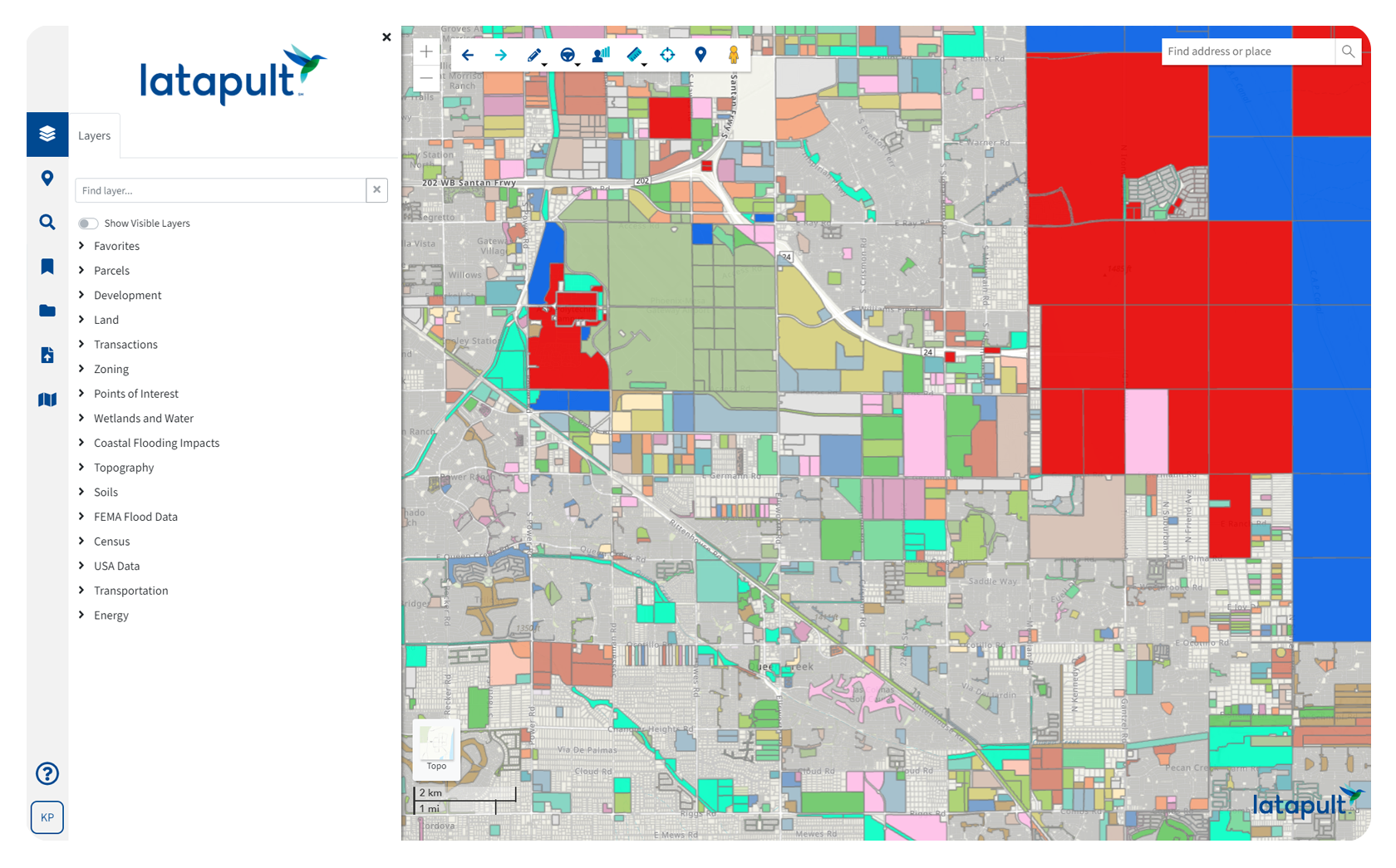
Land Data Built on Esri and Cotality
Access millions of dollars worth of regularly updated GIS data, powering environmental, demographic, geospatial, and topographic insights.

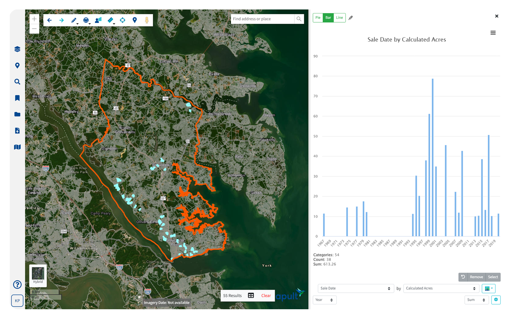
Simplifying Complex Data
Easy-to-use software that makes complex data digestible for confident problem-solving and validated business decisions.

Seamless Stakeholder Collaboration
Combine dynamic GIS mapping with your industry expertise to easily track projects and site status, plus share plans and information with stakeholders.

Personalized Client Support
Gain access to our in-house geospatial experts when you need it.

Cutting Edge and Always Evolving
Have geospatial experts in your corner constantly improving, refining, and expanding how you can apply GIS and use maps to understand land.

Versatile and Accessible
Use our GIS software anytime, anywhere. If you have access to the internet, you have access to Latapult.
Solutions for How You Work
Intuitive mapping and collaboration tools that change the game for anyone who needs to understand land.
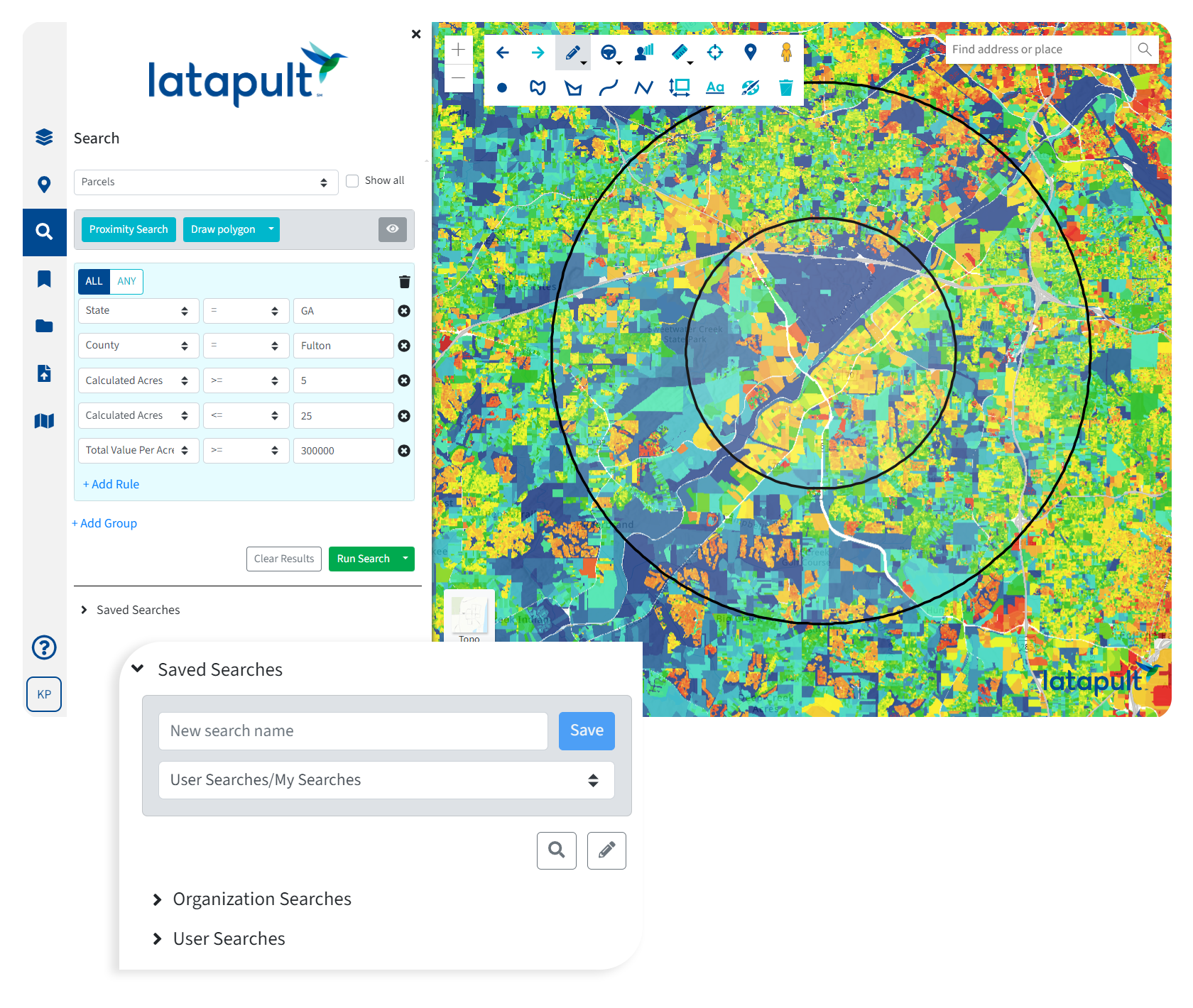
Land Evaluation
Validate business strategy with comprehensive land data and intelligence. Bring the most comprehensive GIS data and insights to your team.
Land Acquisition
Select sites that will attract investor attention and generate returns. Partner with us for land searches, suitability analysis, and site planning.
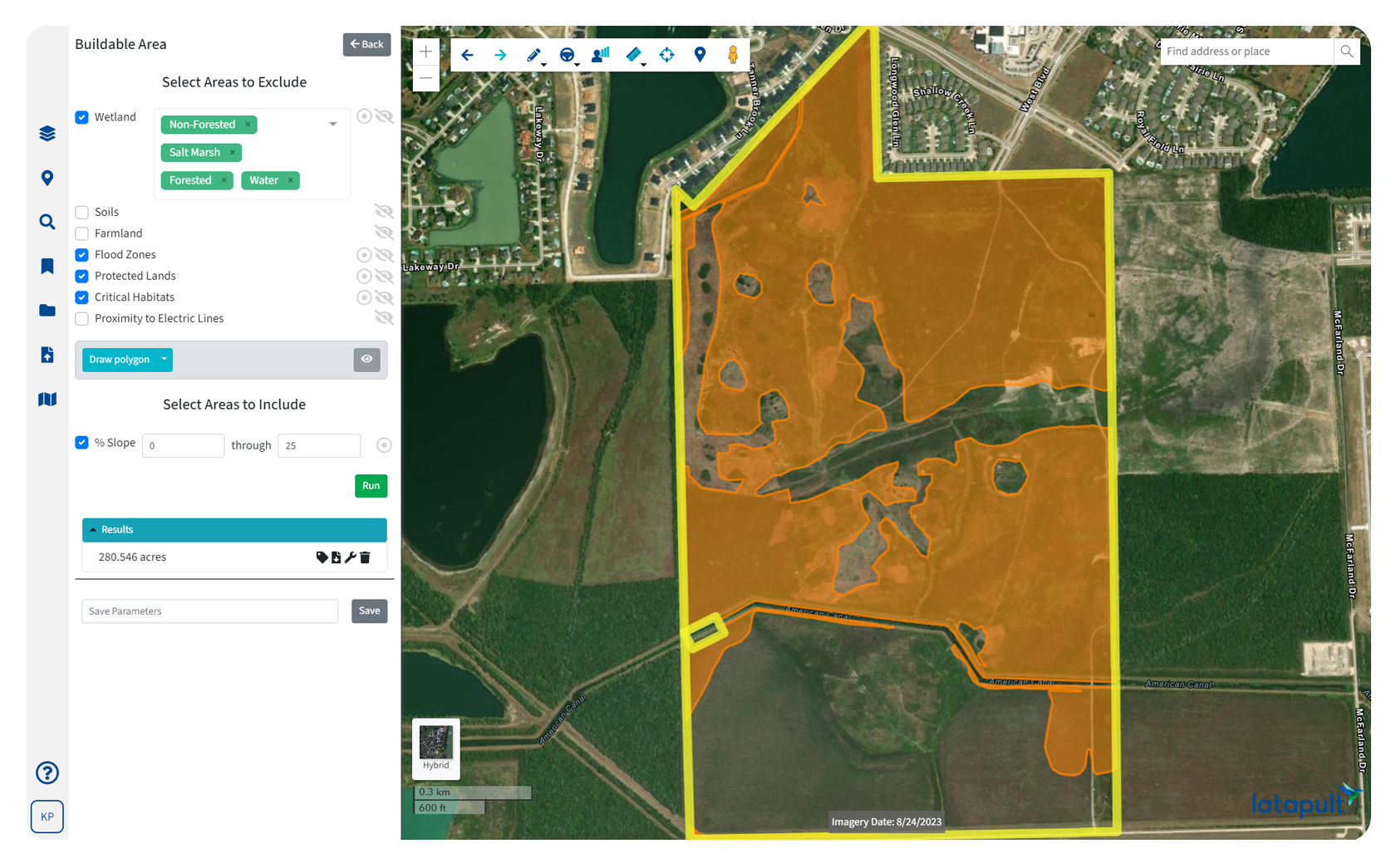
Land Development
Plan, prepare, and execute on site projects by starting with a strong understanding of your location. Share knowledge with distributed teams.
What Our Clients Say About Us

We amplify your industry experience with geospatial expertise.
From our roots in geospatial data analysis, our team of GIS developers and analysts is constantly improving, refining, and expanding how you can use maps to make decisions. We are a trusted partner, helping professionals across industries complete successful projects through collaborative tools and deep insights. We are GIS experts so you don’t have to be.

Integrate GIS with a CRM or project management system.
We understand that sometimes organizations benefit from a tailor-made platform. Our team of geospatial experts work with clients to customize our software whether they need to import attribute-level data, improve workflows with deeper project tracking, or integrate with other systems like a CRM. We love helping clients take our data and collaboration tools to the next level to solve their unique challenges.

Put your trust in experienced hands.
-
300+
Businesses nationwide
Supported in uncovering insights that transform projects.
-
50x
Faster land research
To justify, approve, and negotiate land deals quickly and strategically.
-
$1K+
In savings a month
Per user on resources, labor, and more.
-
250+
Data layers
Powering environmental, demographic, geospatial, and topographic insights.
Launch your land intelligence.
Regions
Save up to 50% with additional users
Powerful GIS mapping and land intelligence tools for regional analysis, parcel research, and collaborative workflows.
Regions Plus
Save up to 50% with additional users
Everything in Regions, plus advanced operational workflows, editable GIS layers, and connected spatial datasets.
Custom Enterprise
Contact for custom pricing options
A fully customized enterprise GIS environment designed around your organization’s workflows, spatial databases, and operational infrastructure.


3 Steps to Streamlining Your Real Estate Workflow with GIS

How GIS Technology Saves Time and Money During Site Selection

4 Ways Technology Can Help Your Buyers Evaluate Commercial Real Estate Investments

Introducing Regions Plus: A More Connected Approach to Land Intelligence

Land Intelligence in the Age of AI: The Best Decisions Require Both

Commercial Development Has Entered the Data-Driven Due Diligence Era

Successful GIS Workflow Expansion Relies on Support System Evolution

Data Center Site Selection Now Prioritizes Power Over Land
