Try Latapult Free for 7 Days
Upgrade your GIS and land search game with the best available data, unlimited mapping, and collaboration tools.
PRICING
Choose Your GIS Product
Regions
$149/mo
Starting price for Metro coverage. Save up to 50% with additional users
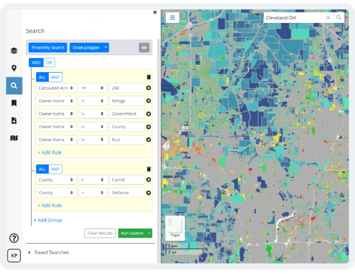
- Property Intelligence
- Smart Land Searches
- 250+ GIS Datasets
- Export Maps & Reports
- Import Data & Web Services
- Buildable Area Analysis
- Premium Infrastructure Datasets*
*Available with State and USA coverage
Regions Plus
$186/mo
Starting price for Metro coverage. Save up to 50% with additional users
All features included in the Regions plan, plus:
- Create Editable Data Layers
- Advanced Symbology & Styling Tools
- Increased Data Storage
Custom Enterprise
Contact for custom pricing options
All features included in the Regions & Regions Plus, plus:
- Custom GIS Layers & Workflows
- Configurable Data Pipelines & Automation
- Spatial Document Management
- Dedicated GIS Experts
What You Gain from a Latapult Regions Free Trial
Robust Tools and Features
From interactive charts and custom graphics to buildable areas and data import tools, our scalable, easy-to-use features help clients evaluate, acquire, and develop sites all while speeding up operations and building trust with clients.
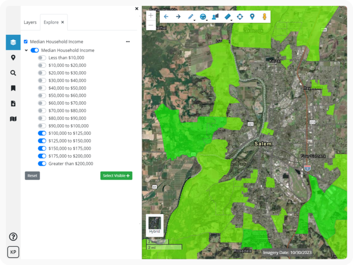
Up-To-Date Datasets
Latapult provides nationwide coverage of property, wetlands, elevation, flood hazard zones, points of interest, census, economic data, and much more.

Tailored Support
We are the GIS experts so you don’t have to be. We are passionate about blending complex data, science, and art altogether in a way that is simple and digestible – enabling you to make quick, informed decisions with confidence. We have your back.

Why Latapult?

Comprehensive Land Data
Access millions of dollars worth of regularly updated GIS data, powering environmental, demographic, geospatial, and topographic insights.

Location-Smart Decisions
Simplify complex data to confidently problem-solve and make validated business decisions.

Seamless Collaboration
Combine dynamic GIS mapping with your industry expertise to easily track projects and site status, and share plans and information with stakeholders.

Trusted Partnership
Get personalized support from our in-house geospatial experts when you need it.

Always Evolving
Have geospatial experts in your corner constantly improving, refining, and expanding how you can apply GIS and use maps to understand land.

Versatile and Accessible
Use our GIS software anytime, anywhere. If you have access to the internet, you have access to Latapult.
