Bigger Data. Faster Maps. Stronger Decisions.
Make Smart Decisions Simple
Latapult’s GIS software changes the game for anyone who needs to understand land.
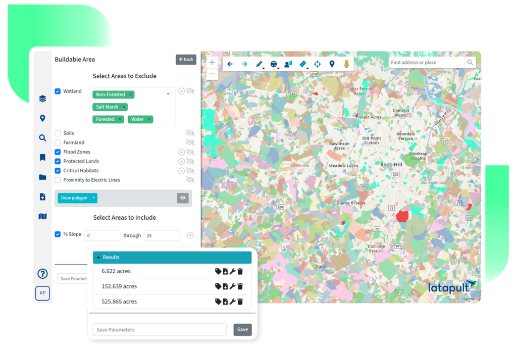
Execute Successful Land Projects Faster
Our high-performance GIS mapping software includes tools for land evaluation, site selection, and development – powered by rich data layers for both large-scale and local queries.
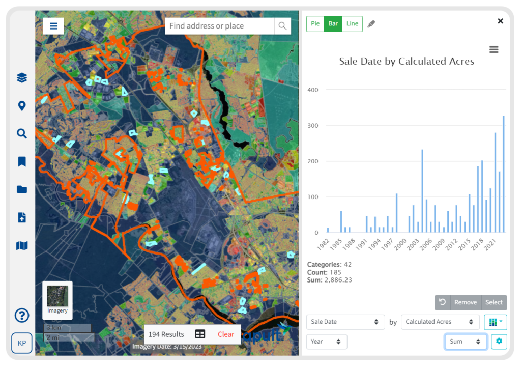
From interactive charts to custom graphics, our scalable, easy-to-use features help clients execute successful projects all while speeding up operations and building relationships.
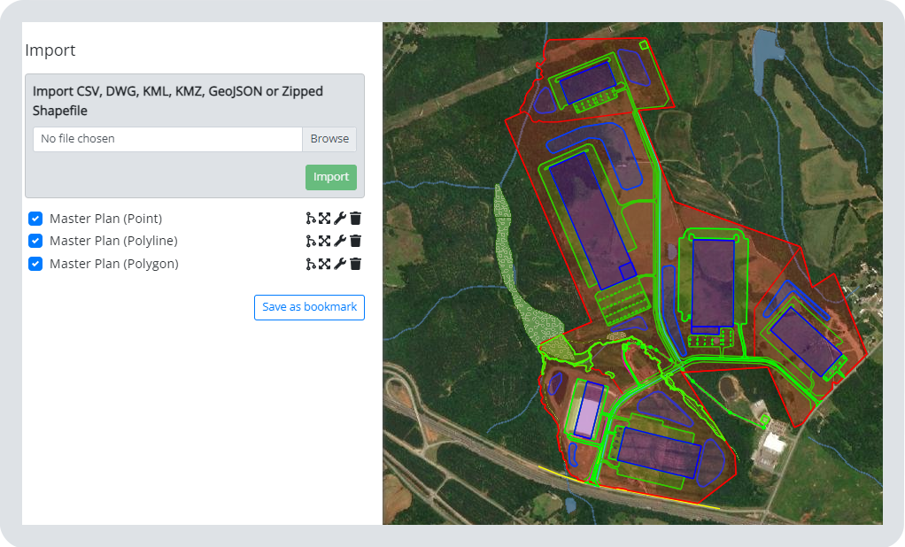
Add Custom GIS Layers and Data Integrations
With customizable features, CRM integrations, and data import tools, combine your existing workflows and create personalized project tracking layers right within our GIS mapping software.
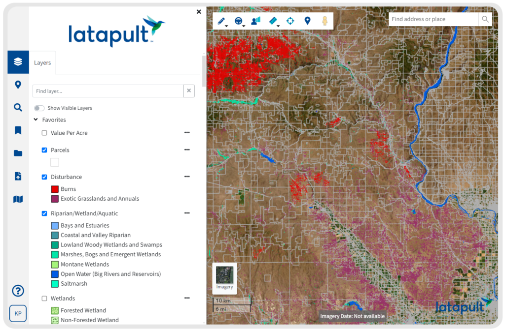
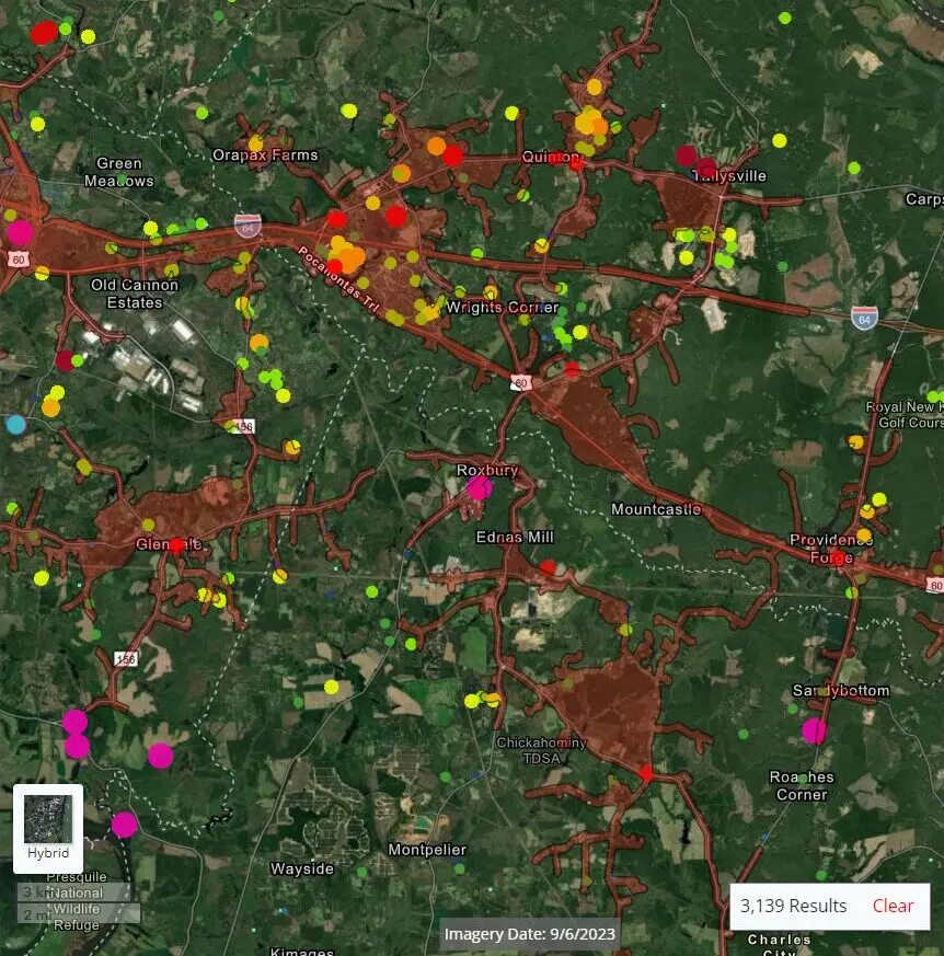
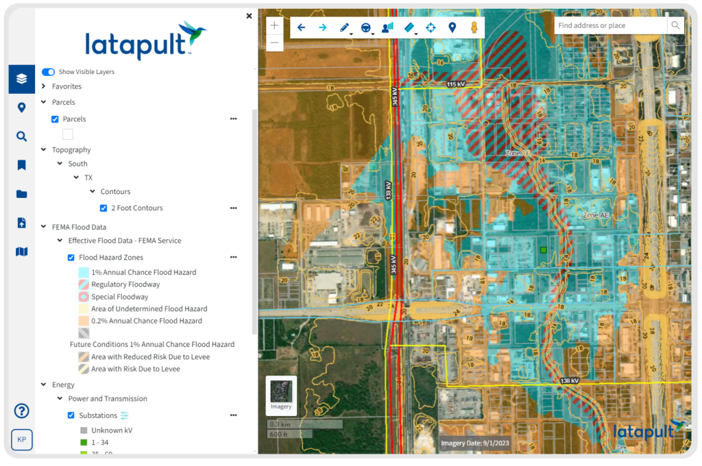
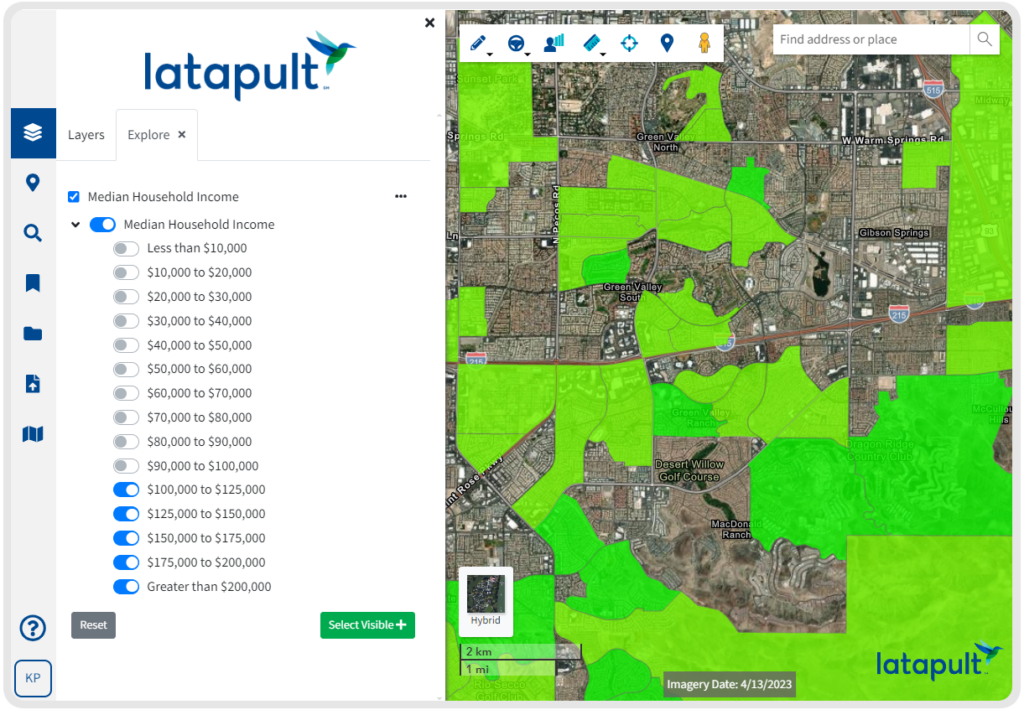
Access 250+ Data Layers for Deeper Insights
Our comprehensive, frequently updated data eliminates manual research processes — providing faster access to the insights and clarity clients need to move projects forward.
Latapult provides coverage of elevation, wetlands, soils, points of interest, land zoning, census data, traffic counts, roads, municipal boundaries, flood hazard zones, large parcel layers, and much more!
Have the Most Up-to-date GIS Data
Thorough and up-to-date information is Latapult’s backbone, and our clients gain access to millions of dollars of GIS data spanning across the entire nation.
It is the most comprehensive you’ll find, refreshed on a monthly, quarterly or yearly basis, depending on our trusted provider sources. Curious when our data was last updated?
Why Latapult's GIS Mapping Software?
Learn More About Latapult's GIS Mapping Software
Land Data Built on Esri and Cotality
Access millions of dollars worth of regularly updated GIS data, powering environmental, demographic, geospatial, and topographic insights.

Simplifying Complex Data
Easy-to-use software that makes complex data digestible for confident problem-solving and validated business decisions.

Seamless Stakeholder Collaboration
Combine dynamic GIS mapping with your industry expertise to easily track projects and site status, and share plans and information with stakeholders.

Personalized Client Support
Gain access to our in-house geospatial experts when you need it.

Cutting Edge and Always Evolving
Have geospatial experts in your corner constantly improving, refining, and expanding how you can apply GIS and use maps to understand land.

Versatile and Accessible
Use our GIS software anytime, anywhere. If you have access to the internet, you have access to Latapult.
GIS Mapping Solutions for How You Work with Land
With comprehensive data, intuitive mapping, and collaborative tools, Latapult tailors insights for site planning and location intelligence.

Roles
Whether you work in analysis, acquisition, or development, Latapult is your trusted partner.
Discover GIS for All Land Roles Discover More about Latapult Roles
Industries
From renewable energy and utilities planning to homebuilding and commercial development, Latapult brings clarity.
Discover GIS for All Land Industries Discover More About Latapult IndustriesPut your trust in experienced hands.
-
300+
Businesses nationwide
Supported in uncovering insights that transform projects.
-
50X
Faster land research
To justify, approve, and negotiate land deals quickly and strategically.
-
$1K+
In savings a month per user
On resources, labor, and more.
-
$1M+
In GIS data
Powering environmental, demographic, geospatial, and topographic insights.