How to Take Latapult’s GIS Mapping Software to the Next Level
June 7, 2022
Traditionally, land development decisions were made based on information found in scattered and outdated resources. This changed with the introduction of GIS and interactive mapping systems. With easy-to-access mapping applications like Latapult, land professionals can make smarter, faster, and easier decisions based on ownership boundaries and contemporary land data.
Our tools and datasets are extensive, and Latapult users often think they are using every tool and capability to its fullest potential within the platform. But often there is even more to explore.
Latapult offers an array of solutions from land and proximity searches to map visualization and exploration for all industry professionals to level up their land projects. Keep reading to learn about our various tools and data layers that can help your team take your use of Latapult to the next level in order to stay ahead of competition, client needs, and more.
GIS Mapping Software To Level Up Land Projects
Some of our most used tools and layers include the Buildable Area tool, nationwide property searches, and our due diligence layers. However, outside of these, we have a variety of others that can make your use of Latapult even more impactful. Below are just a few that can further help your team level up your next project by speeding up land development workflows and making project management even easier.
Area Report

This tool is super quick and easy to use and will allow Latapult subscribers to generate a PDF version of an area report that includes various figures, charts, maps, and datasets such as soil type, acreage, detailed wetlands figures, flood zone numbers, and more. Data points within the area report will allow land professionals to easily determine how buildable their land is and make important decisions when it comes to infrastructure.
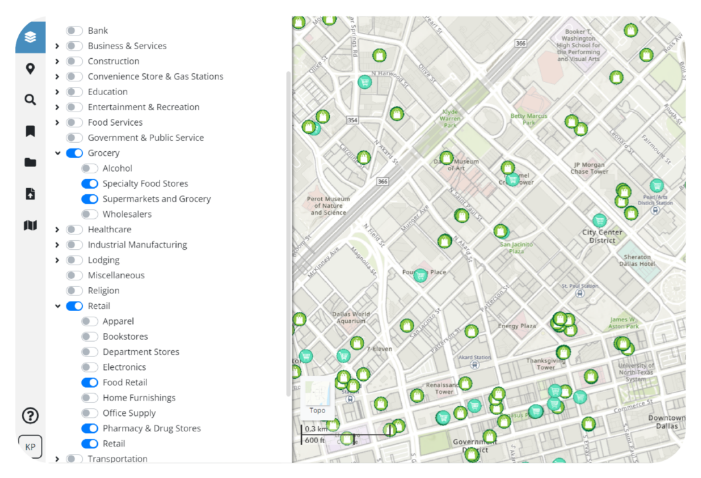
Points of Interest
With this tool, users can create maps or use them as search points to see local amenities around a parcel of land. For instance, the driving time feature allows you to view points of interest within driving distance of your project. This feature can help determine how popular and desirable the area around your project is to buyers, future residents, and more.
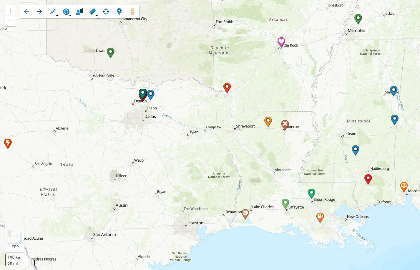
Sharing of Pins & Bookmarks
Many Latapult users gravitate to the Pins and Bookmarks tools as they provide an easier way to track the status of projects and land leads. Along with providing a better way to organize projects, Pins, and Bookmarks can also be shared across land teams to achieve better project alignment and team collaboration as everyone will be on the same map.
Measuring Tools
This tool allows users to measure distances, acreage, and latitude and longitude coordinates of a site. Our Measuring Tools provide accurate calculations of land data parameters, so you can take the guesswork out of estimates.
Number Parcels
While embarking on a new or existing land project, land professionals need reliable GIS to identify the potential gaps and areas of opportunity in a parcel. Taking this further, GIS can also help with understanding minute details, like land value and the elements that make a location desirable, to further ensure the success of a project. With the Parcel Number feature, Latapult users can create property maps with numbered parcels and corresponding ownership tables for up to 100 properties to easily evaluate a variety of land and better visualize, strategize, and organize land data.
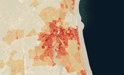
MSA Layers and Associated Data
The MSA layer tool allows users to quickly visualize population density and analyze population changes per metropolitan area within the last 1, 2, 5, and 10 years. In addition, associated data can provide users with the ability to see building permits obtained per area, normalized by population amounts, in order to conceptualize where growth is rising rapidly. Lastly, users can view and analyze jobs on a monthly basis along with unemployment rates. This feature can help determine the suitability of a site in relation to a population and the path of development.
Custom Latapult Mapping Layers
Rather than having to simply draw graphics or import CAD or shapefile data into Latapult, custom layers allow land professionals to utilize Latapult to add, build, and manage their own GIS data. Having custom Latapult layers along with the deep base data that Latapult provides is beneficial in helping teams further see and understand patterns or relationships on a map.
By using each of our tools and datasets available, your team can capitalize on the power of Latapult and use it to stay ahead of the competition.
Upgrading User Packages and Data Plans
Whether you’ve used the tools we’ve discussed, or you’re planning to dive in further to get more out of your next project, there is no better way to understand the true power of our technology than by discussing the possibilities with one of our GIS experts. We’re happy to discuss your specific use cases to see if you’d benefit from data plans ranging from USA, Metro, and State specifications, adding users for improved team collaboration and department sharing, and more.
Ready to take Latapult to the next level? Click here to contact our customer success experts to learn how!


