
The Power of Pins & Group Sharing Through GIS Software
July 13, 2021
A successful land development project requires collaboration from multiple stakeholders, but that’s easier said than done when you factor in all the site visits, data, and team members involved. Technology solutions that are capable of finding buildable land, meeting client demands, and collaborating with teams anywhere, anytime are key to solving this challenge.
In order to help these land stakeholders remain organized and connected, whether they are in the office or at a job site, the Latapult platform has tools such as pins and bookmarks that are easily accessible wherever and whenever, through a desktop, smartphone, or tablet. These features help teams share data and ideas with the click of a button.

How Latapult Pins Can Enhance Your Workflow
There are a lot of moving parts when it comes to land acquisition, surveying, development, and construction processes. And depending on intensive workflows, it can be difficult to stay organized and in touch with team members that are spread out between on-site and in-office roles.
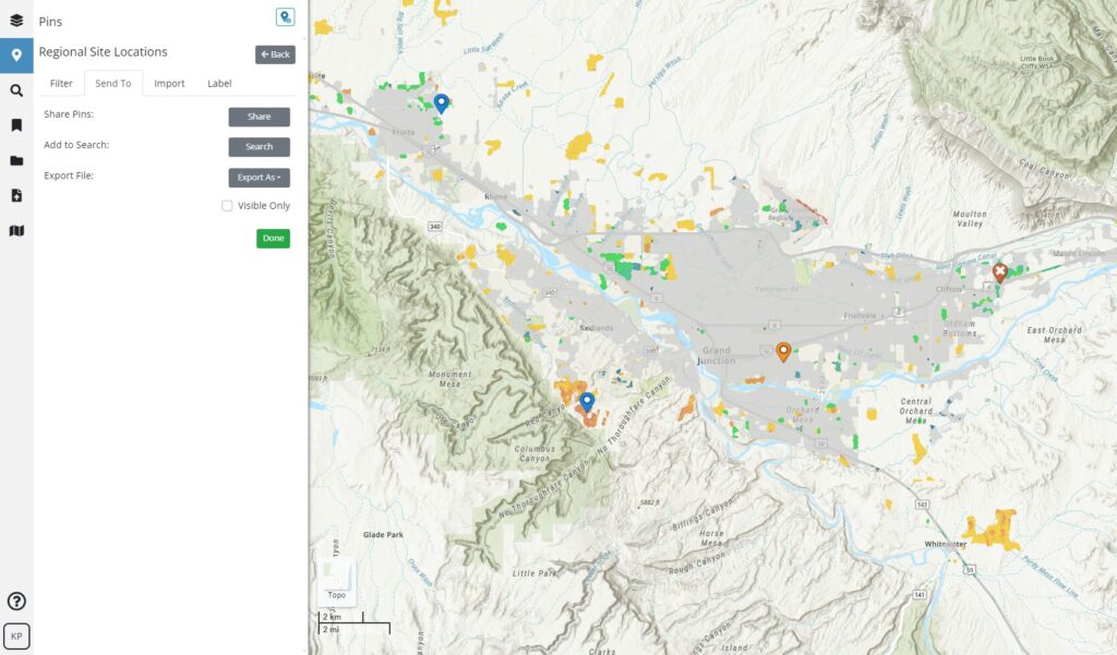
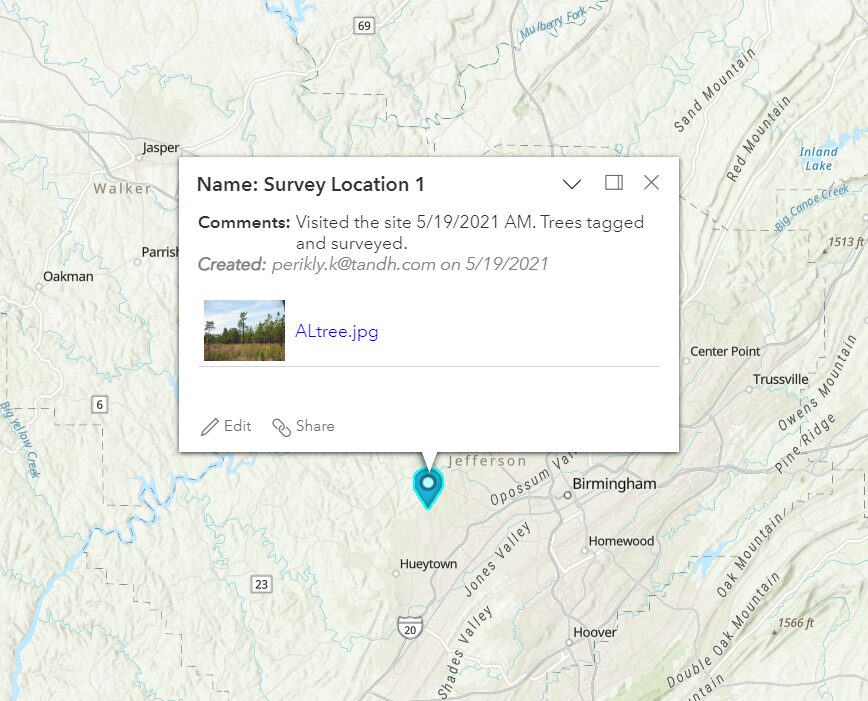
With Latapult pins, users have found a better way to manage the due diligence process, track potential land deals, and collect site data both in and out of the office. For instance, when called to a site, you can simply drop a pin on a map to attach notes to a specific location or add related documents and photos that can be viewed either by you or your team at a later time on any device that has Internet access.
With Latapult, you don’t have to worry about losing an idea on the go. Just import geotagged photos straight from your mobile device and review them in Latapult on your desktop when you return to the office.
How Group Sharing Can Increase Team Collaboration
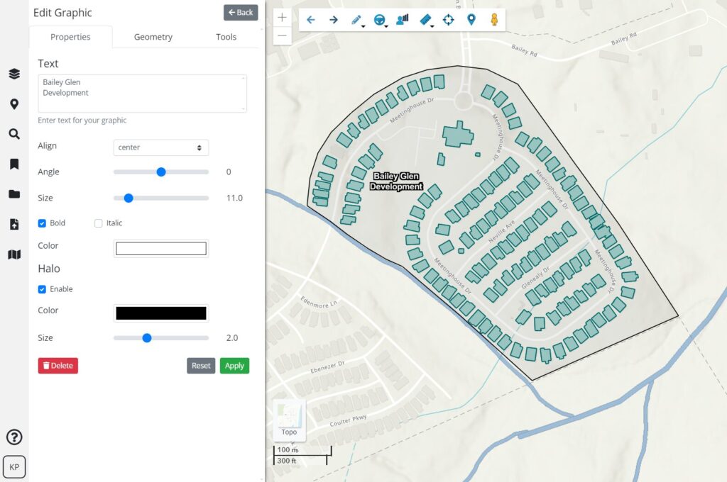
In addition to personal workflows, Latapult users can use bookmarks and graphics tools to achieve better project alignment and team collaboration. Bookmarks allow you to save any graphics on a map that you have created so that you can go back to it later or share it with your team. For example, you can use bookmarks to save land mapping analysis for each of your projects and use graphics tools to customize and create PDF maps of your projects that can easily be shared with clients and business partners to increase project visibility.
From pins to bookmarks and graphic tools, combined or individually, these features allow you to improve both internal and external collaboration, all without leaving the Latapult application.
Want to learn more about these important GIS collaboration and project management tools as you embark on your next land development project? Dive deeper into our solutions here


