
4 Ways Technology Can Help Your Buyers Evaluate Commercial Real Estate Investments
August 12, 2020
Commercial real estate is a broad industry. From retail, industrial, offices, multifamily and more, it’s no wonder it’s ranked #1 in real estate market size in the U.S. This breadth means that CRE professionals are charged with having a wealth of information about properties and their potential use cases – knowledge that has historically come from disparate sources and often outdated data. Now, CRE tech is transforming how agents and brokers gather and present insights to their clients.
Experts forecasted commercial real estate transactions to reach $478 billion in 2020. Despite our recent economic downturn, interest rates are on the decline and CRE investors are looking at this opportunity to make smart, financially sound decisions.
4 Ways GIS Helps CRE Buyers
How can you help these buyers find potential properties that are right for their business goals? Read on to discover four ways CRE tech can help you drive investments with confidence.
1. Identify Vacant Land
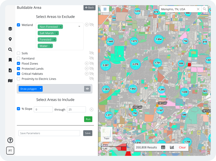
Commercial real estate success heavily depends on the physical location of a property. Through CRE technology, professionals can search for vacant land based on acreage or proximity to other commercial properties through visualized data.
2. Explore Environmental Risks
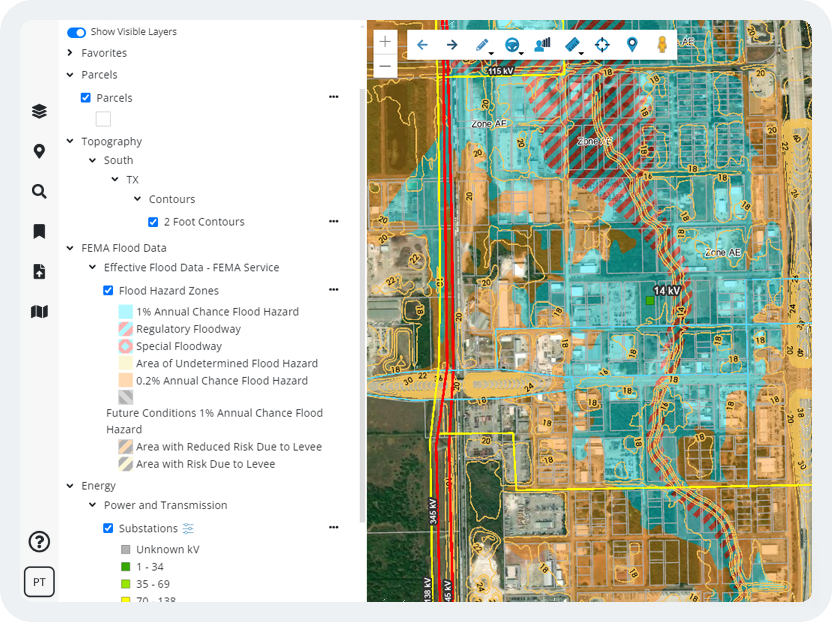
Environmental factors make a considerable difference to the success of a project. Commercial real estate technology allows you to explore data layers so that you can have a better idea of a property’s environmental conditions, including wetlands, soils, elevation, and FEMA maps.
3. Create Demographic Reports and Property Flyers
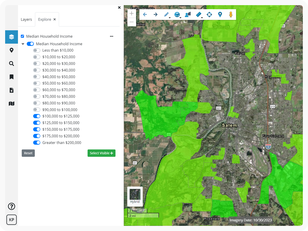
With technology, commercial real estate professionals don’t have to rely on predictions, observations, or piecemeal data sources. Instead, create visual demographic reports and faster property flyers to compare locations and areas of interest.
4. Conduct a Retail Gap Analysis
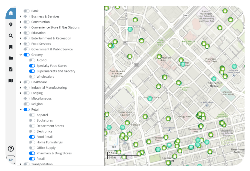
Taking it a step further, GIS technology provides geospatial tools that allow users to map supply gaps in a particular area. For instance, a convenience store developer can conduct a gap analysis using drive times from existing stores to find the perfect busy intersection with adequate traffic counts where competitors may not be filling the current demand. It can be critical to help your buyers understand if a prospective property is located in an area where gaps or voids in retail supply exist.
Latapult’s CRE Tech Platform Drives Smarter Decisions
With Latapult, commercial realtors can quickly find properties across the county on one platform. Latapult has property ownership data and land layers for the entire U.S., allowing commercial real estate professionals like you to create detailed searches across multiple counties at once.
But don’t just take our word for it, our customers recommend our easy-to-use tools too. “Latapult is a heck of a resource for anyone in commercial real estate,” said Chuck Mitchell, Senior Commercial Sales Associate, Parker Scott Commercial.
Latapult is a heck of a resource for anyone in commercial real estate.
Chuck Mitchell, Senior Commercial Sales Associate, Parker Scott Commercial
Ready to make informed commercial real estate recommendations? Learn about our site selection software


