4 Tips for Getting Started with Latapult’s GIS Platform
March 16, 2022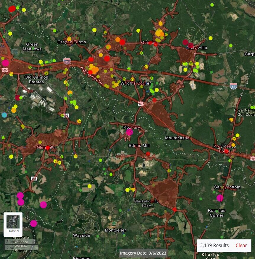
Latapult was built to make GIS technology accessible and easy to use for any and all industry professionals. Whether your team is from the solar, municipal, AEC, or real estate industry, our GIS platform will work for you.
Read on to learn how to get started.
1. Comparing Plans
Our mapping platform is easy to start using. The first step is choosing one of our plans, which are tiered based on the type of information needed for upcoming projects. From city to nationwide level, we have three options available:
- Metro: Explore properties in growing metropolitan areas across the country
- State: Search for land across your selected state in seconds
- USA: The entire country is instantly available at your fingertips
Certain plans will be more beneficial to specific industries and use cases. Solar developers, for instance, may cover the entire United States, while commercial brokers may only focus on one metropolitan area, which is why we’ve tailored our plans with these varying needs in mind.
Within each plan, Latapult provides access to critical land data, including property boundaries, elevation, wetlands, soils, flood hazard zones, and more. Each of these individual data layers can be beneficial on its own in addition to providing a comprehensive picture of land suitability. For example, wetlands data allows land developers to evaluate the risk vs. reward factor of building within the area. Pro-tip: Is proximity to electric infrastructure crucial for your development? Our State and USA packages include substations, transmission lines, and other Energy-related datasets.
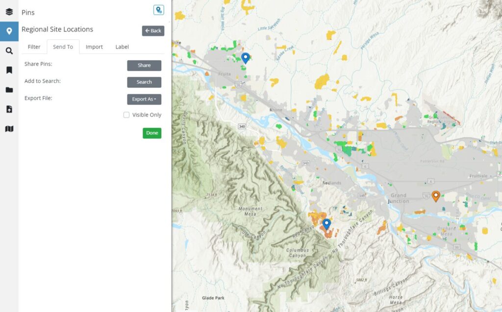
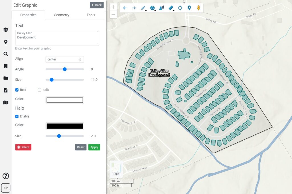
Each plan also comes with a suite of mapping tools, including easy-to-create graphics, eye-catching PDF maps, a buildable area tool to visualize developable land, bookmarks to save project boundaries and sites for easy access during presentations, and pins to track properties and attach site-related documents, all on an easy-to-use map-based interface.

2. Choosing User Packages
After you’ve chosen your plan, the next step is to decide how many users you will need. By choosing a single-user agreement, individuals can start off slow and steady with our platform before deciding to hit the ground running. This package may also be best for individual brokers and agents who tend to work solo.
But our team-based tools are some of our users’ favorites – offering cross-team collaboration and data sharing. Explore pin groups and live bookmarks to make communication easier by storing and sharing information all within the application. To start off with a user package large enough for your whole team, we offer 3, 5, and 10-user packages. If more than 10 users are needed, contact our support team to discuss the options.
In addition to the opportunity for increased team collaboration across various departments under the same plan, team packages also earn a greater discount towards your entire package. Pro-tip: the more users you have, the more of a discount per user your team will receive.
3. Starting With A Free Latapult Trial
If you can’t decide what size user package your team will need, don’t worry – we offer free trial runs. Our free trials are offered in the same user increments as our paid offering, and they allow users to share data and explore our GIS platform and tools to help determine the data plan and user package that is best. Pro-tip: we recommend adding team members to your free trial, so you can experience our collaboration tools.
4. Importing Other Data
While getting a feel for how our GIS platform works, you’ll also discover that you can import other data sets as Latapult graphics to get a holistic view of a chosen land plot or property. Latapult was designed to work alongside systems like CAD to keep multiple data sources in one place and enhance the site selection and design process. By importing other data sets into the Latapult platform, teams can quickly visualize land plans against dozens of Latapult data layers for a fast, in-depth look at surrounding environments. Pro-tip: If you’re interested in permanently importing your data as an integrated layer, contact us for more information about a custom plan.
After completing each of these steps, teams can spring into action with Latapult’s GIS platform quickly and easily.
Check out our FAQ if you have additional questions about our GIS platform, and sign up for a free trial to get started with Latapult!


