
Land Mapping Software for Solar & Renewable Energy Site Selection
Latapult’s GIS mapping software helps solar and other renewable energy developers make confident, cost-effective land decisions. In a market where every dollar counts, the platform provides clarity to complex land data, allowing you to focus on high-potential sites and move forward with confidence.

Make Faster, Smarter Decisions
Maximize Every Dollar of Your Budget

Stop Wasting Time on Scattered Data
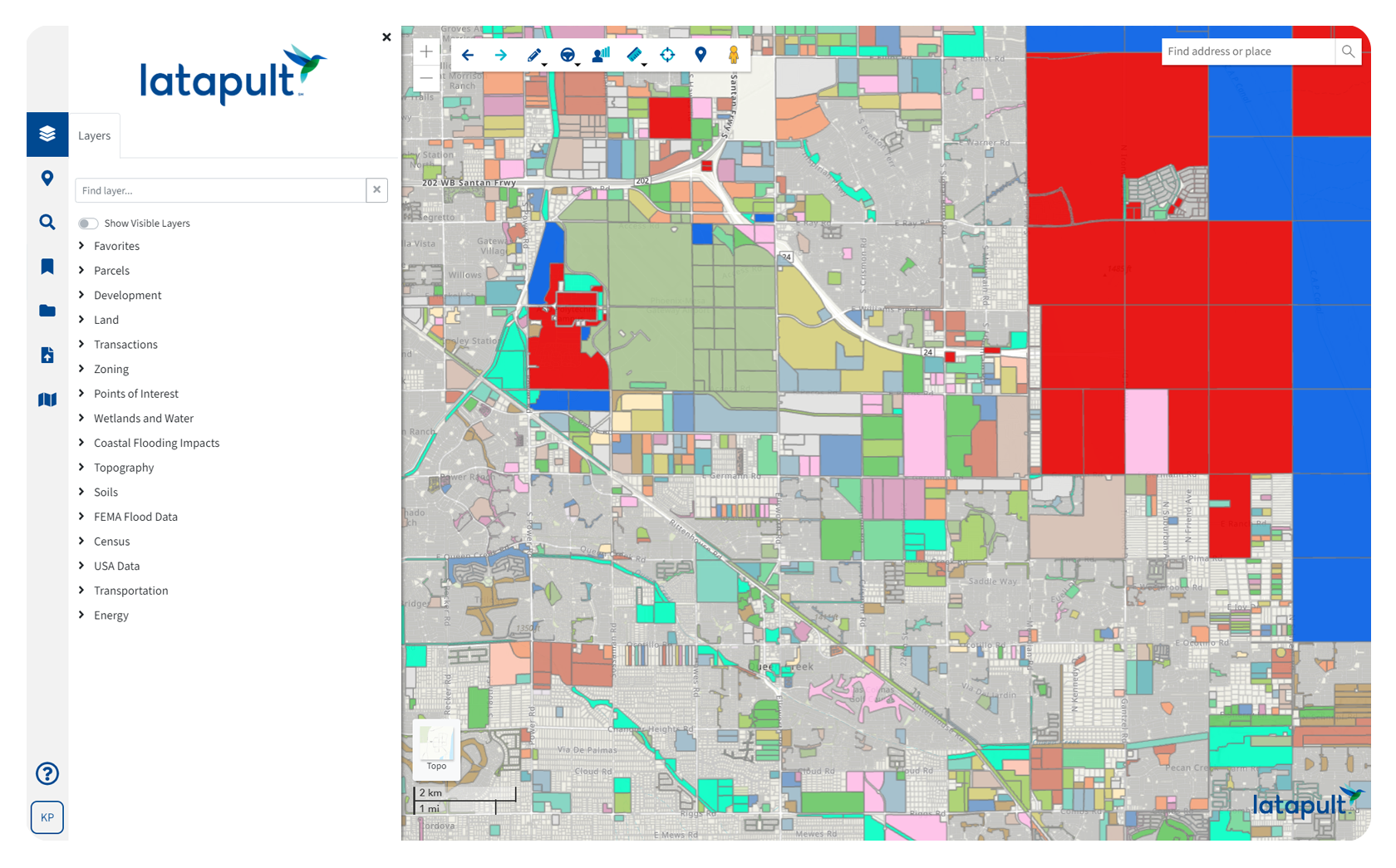
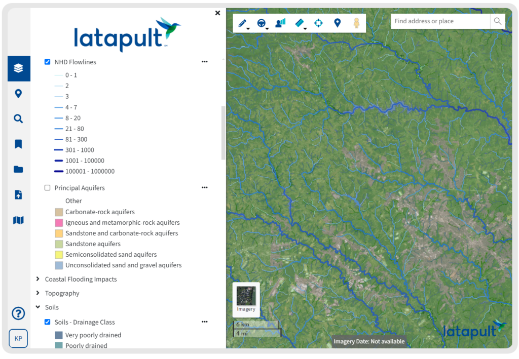
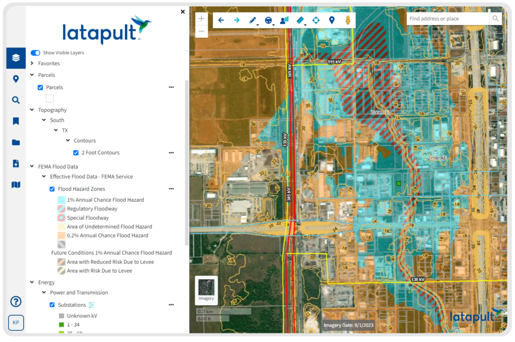
Get nationwide land and parcel data in one place, with built-in layers for topography, zoning, floodplains, wetlands, and more.

Find Sites That Actually Pencil Out
Evaluate properties based on solar-specific criteria like transmission lines, substations, acreage, and buildable area.

Cut Due Diligence Costs
Identify red flags early to avoid wasted spend and keep project budgets on track.

Make Decisions You Can Defend
Visualize and compare shortlisted sites side by side to make clear, data-backed decisions.

Share Insights, Not Spreadsheets
Collaborate with internal teams and stakeholders using built-in tools and intuitive visuals.

Get Data Others Leave Out
See the complete picture without cherry-picked data layers or confusing workarounds. What you see is what you get—and what you need.
Find the Right Site. Avoid the Wrong Spend.
Latapult doesn’t just present data. It structures and interprets complex U.S. land information through purpose-built tools that reveal what matters most to solar and renewable energy development.
- Search land near substations and transmission lines
- Evaluate buildable acreage, slope, wetlands, and flood zones in one view
- Determine surface access and terrain issues before they impact
development
- Filter by solar-relevant attributes to prioritize viable sites
- Generate visual outputs to support planning, collaboration, and buy-in
Put your trust in our experienced hands.
-
45K+
Bookmarks saved
Tracking what matters most—site by site, map by map.
-
60K+
Graphics created last year
Bringing solar insights to life through charts, visuals, and layers.
-
5.5K+
PDF maps exported
Custom downloads that guide solar planning and proposals.
-
85K
Searches run by solar users
Helping teams explore and evaluate key sites faster than ever.
GIS Data That Keeps Every Variable Visible
You don’t need more data—you need the right data. Latapult brings together the land, utility, and environmental layers that matter most to solar and renewable energy development, including:
- Parcel and Transaction Data – Review ownership, acreage, and sales history
to surface viable opportunities
- Energy and Utility Data – Map substations, transmission lines, and service
areas to guide siting decisions
- Wetlands and Water Data – Flag environmental barriers before they slow
down your timeline
- Topography Data – Understand slope and elevation to assess buildability at
a glance
- Economic Development Zones – Spot Opportunity Zones and qualified
tracts to boost project ROI
- Transportation and Access Data – Check proximity to roads, rails, and traffic patterns for logistical planning
Rather than tracking down available property data and sifting through multiple sources to find out if prospective land checks all the boxes for a renewable energy development, clients can search, manage, and evaluate land data in Latapult based on exact criteria.
GIS Built For Renewable Energy Site Discovery
Latapult makes it easy to evaluate, compare, and share potential solar and renewable energy sites—all in one place.
- Drop pins to mark and annotate properties with renewable energy
potential
- Apply the Buildable Area Tool to quickly calculate usable acreage
- Use bookmarks to track and compare high-priority sites
- Export maps to share with internal teams and project partners
- Import external site plans and overlays for added context
- Filter for specific traits to surface promising zones early
Tailored to Solar & Renewable Energy Siting
Latapult is built to support most solar and renewable energy teams right out of the gate. But when projects need something more specific, our team can help customize the platform to better fit your workflow.
- Connect with internal systems like CRMs or databases
- Import and visualize custom attribute-level datasets
- Build workflow tools that match your internal process
- Extend features to support long-term project tracking
- Get guidance from GIS experts who understand your goals


Frequently Asked Questions
-
What is the application of GIS in environmental impact assessment?
GIS helps assess the potential environmental impact of renewable energy projects by layering data, including wetlands, flood zones, topography, protected areas, and wildlife habitats. By visualizing and analyzing this data early in the planning process, developers can identify risks, avoid sensitive zones, and streamline permitting.
-
How can GIS data help me select renewable energy site locations?
GIS helps renewable energy developers evaluate key siting criteria in a single location. You can analyze land availability, solar irradiance, slope, transmission access, and proximity to substations. This makes it easier to rule out low-potential sites and quickly zero in on high-value opportunities.