How AEC Firms Achieve True Collaboration Through GIS Technology
February 26, 2021
Architects, civil engineers, and construction teams are not the only parties involved in the completion of an AEC project. Between creating a plan, managing client communications and completing a project, firms need both strong internal and external communications to succeed.
Despite the need, many AEC firms have either not yet implemented the right solutions to master true collaboration or don’t maximize the tools they have to unite their team and build client relationships. We understand that there are a lot of moving parts in your firm, and with the right technology you can achieve better collaboration from start to finish.
Fitting GIS Into Existing Workflows to Manage Internal AEC Teams
When implementing new technology, we recommend working from the inside out and focusing on internal workflows first. GIS technology like Latapult is designed to help manage land projects from top to bottom all in one centralized platform.
With GIS-based project management tools, data and maps can be shared among entire AEC teams to achieve better project alignment. Here are some of the specific GIS tools your team can implement into existing workflows:
- Land Searches: Before you begin a project, your team must first help clients through the site selection process by helping them find suitable land. With GIS, your team can guide clients to make better land decisions by easily searching properties across county and state lines.
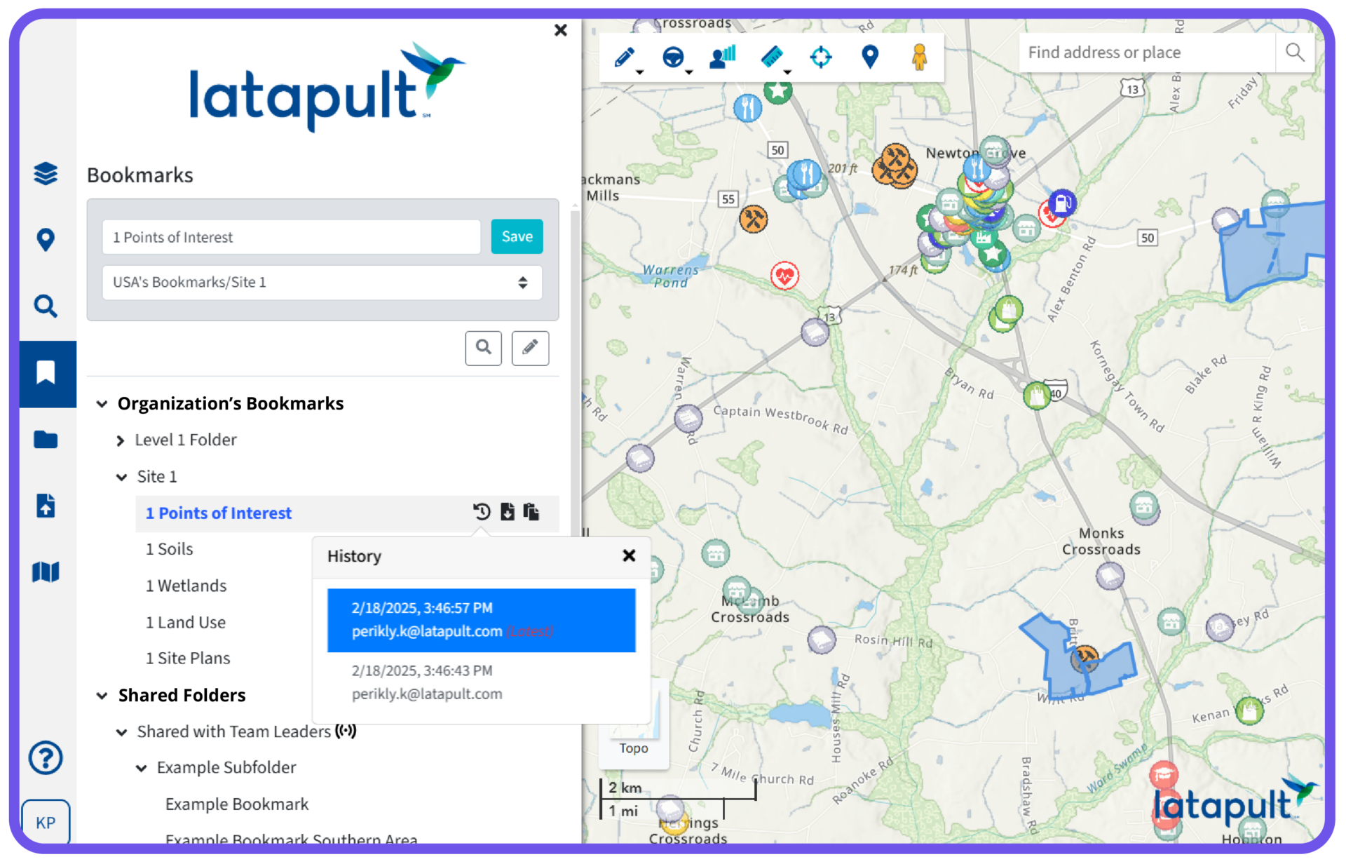
- Bookmarks: Once land is found, your team can use bookmarks to save site boundaries and create an inventory of active or prospective projects. These bookmarks can then be shared with other members of your team or exported to share with clients so that all individuals are on the same page during the planning phase.
- Imports: When project execution is underway, project managers can import land plans and site designs which will help in visualizing the layout of a project with respect to surrounding land layers. What’s more, these plans can be accessed on a mobile device so that you can have them in the palm of your hand during a physical walkthrough of a project.
Improve Client Satisfaction Through Collaboration With Latapult
Now that your firm is well organized, you can focus on using technology to enhance your client relationships. With Latapult, you can help save your clients time and money by providing guidance throughout site selection, land development and more using these tools:
- Interactive Maps: Import your client’s site plans to help them picture future development scenarios your team has designed. This will help clients make more informed decisions.
- Pins: During the due diligence phase, project managers can use pins to attach related documents and important information to a site project within Latapult. This will help in tracking the status of a project and can be shared and edited by various team members that have been added to specific pin groups.
- Map PDFs: Once your client is ready to move forward with each step of your AEC project, you can create PDF maps for reports to keep your client informed of project updates.
- Presentations: Finally, you can use Latapult during a client meeting as an interactive presentation. With it, you can answer your client’s questions, whether specific to the project or about surrounding land, on the fly. For example, our customers often use bookmarks to show different project boundaries during meetings, helping clients learn about land elevation, water features, neighboring parcels, nearby points of interest, and more, all without leaving the application.
Want to align your team while improving your client relationships? Here are some of the most common GIS workflow questions answered


