All Roles
5 Under-the-Radar GIS Mapping Data Sources Every Land Stakeholder Should Use
July 27, 2017
- United States Geological Survey (USGS)
- National Resources Conservation Service (NRCS)
- United States Department of Agriculture (USDA)
- National Aeronautics and Space Administration (NASA)
- U.S. Census Bureau
The GIS Land Mapping Data Sources to Know
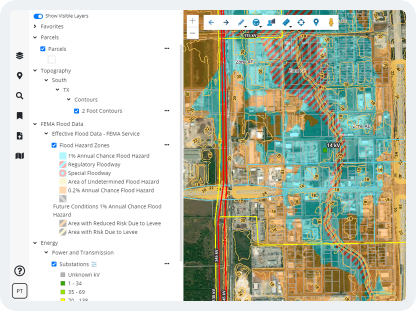
- Parcel Data – Land stakeholders have traditionally shied away from obtaining and analyzing parcel (property) data because there hasn’t been a centralized, extensive and affordable source to manage the process. But parcel data can provide important information for property analysis, such as sale price, acreage, zoning code type and assessed property value.
- FEMA Flood Hazard Zone Data – When land stakeholders search for a property, they may or may not be told by the broker or property tax card if it is in a flood zone, which can affect the price of development drastically. FEMA flood zone maps should never be overlooked.
- U.S. Census American Community Survey (ACS) – Many land stakeholders are unaware that every year a small sample of U.S. residents are surveyed to create Census data estimates. Although “estimates,” such data is very reliable in showing important trends regarding income, population change, migration and home prices on regional and city scales on a more frequent basis than the official census.
- Traffic Counts – The Department of Transportation (DOT) in each state produces yearly traffic count data on all classes of roads. Such GIS transportation data is not commonly used by people outside the traffic engineering industry, but it can provide important data to make business location and land use planning decisions.
- LiDAR-derived Topography and Contour Data – When developing land, an exhaustive topographic (ground surface elevation) survey of the lot or area may be required before any planning can begin. This initial planning process can be quicker and cheaper by using highly accurate, LiDAR-derived elevation contour data.