How to Overcome Solar Land Development’s Four Biggest Challenges
July 26, 2024
The RE+ (formerly Solar Power International) annual conference is just around the corner. So, let’s talk about four challenges we frequently encounter. Our solar land development customers often come to us in the face of opposition — searching for better ways to find and manage projects. Read on to learn how the right technology can solve some of the top challenges they experience.
Challenge 1: Finding Land that Meets Project Needs
The first and biggest step for successful solar land development is to find a property in close proximity to the grid. But that’s often not an easy task. For instance, developers can find themselves spending days combing through county records or aerial photography for the data they need to find proper distribution lines, transmission lines and substations.
Solution: With GIS technology, solar developers can access this data all in one place in just minutes. Therefore, developers no longer have to spend countless hours dissecting data, which makes it easier to search for and identify just the right property.
Challenge 2: Managing Risks of Solar Land Development
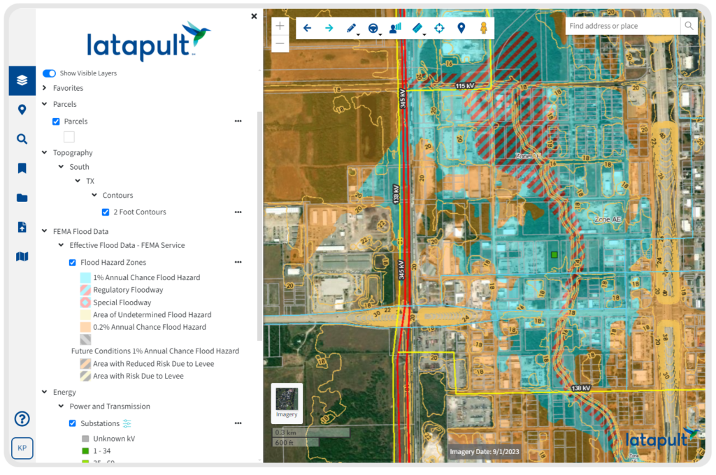
Due to the challenge of finding property near the grid, development professionals can find themselves quickly investing in a property once they’ve identified one in close proximity to the right infrastructure. But there may be hidden risks not visible to the naked eye. For instance, a developer may invest in a seemingly suitable property, only to discover that the land is in a flood zone or wetland.
Solution: Through GIS technology, solar land developers have the ability to assess risks before they occur by reviewing potential pitfalls such as topography challenges, wetlands, land buildability and more.
Challenge 3: Gaining Financial and Investor Buy-In
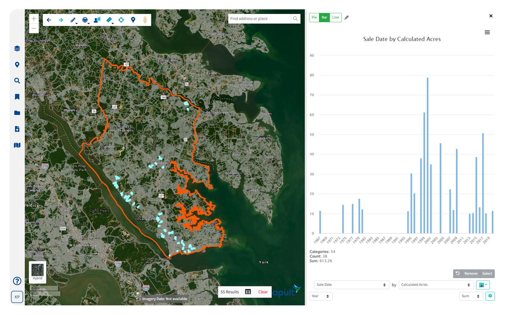
Once developers have found what they believe is the right property for their next project, they have to prove the land’s value to potential investors to gain financial buy in. While developers are close to the research and clearly understand the potential of the land, investors are typically more distant from the project and need clearly outlined points to understand how a particular piece of land will produce a return.
Solution: Innovative GIS mapping tools can help developers create interactive presentations, custom graphs, maps, plans and more. These tools can help investors better visualize the potential of a project with all of the data in one place.
Challenge 4: Keeping Teams Organized
After investor buy-in, solar land developers are ready to begin executing their plan. They have a clear vision and hire a strong team to back them up. But managing large teams can be overwhelming and often disorganized.
Solution: Solar land developers can better manage teams of all sizes and provide easier collaboration from top to bottom and across state lines through GIS technology. With this tech, project managers can easily share ideas, data visuals, maps and more all in one place.
Want to learn more about how a geographic information system can help your business thrive? Click here to learn more about Latapult.