Land Development

Data Center Site Selection Now Prioritizes Power Over Land

For decades, real estate development followed a golden rule: “location, location, location.” In the data center sector, that mantra has evolved. Today, it is “power, power, power.”

In major digital infrastructure hubs like New Albany, Ohio, securing a parcel of land is no longer the primary hurdle. Developable acreage is often plentiful. The true bottleneck — and the factor that kills deals faster than zoning issues or soil quality — is the ability to secure the necessary gigawatts to run the facility.

The industry is currently contending with a collision between unprecedented demand and shrinking grid capacity. Utilities are responding by tightening regulations, and grid operators are projecting massive load growth. For developers, this means the traditional site selection playbook is obsolete. You cannot buy land and assume power will follow. Instead, infrastructure visibility must drive the search from day one.

To navigate this high-stakes landscape, teams are turning to advanced GIS platforms like Latapult. With deep insight into power frameworks layered alongside parcel data, Latapult users can identify power-ready sites before making significant capital investments.

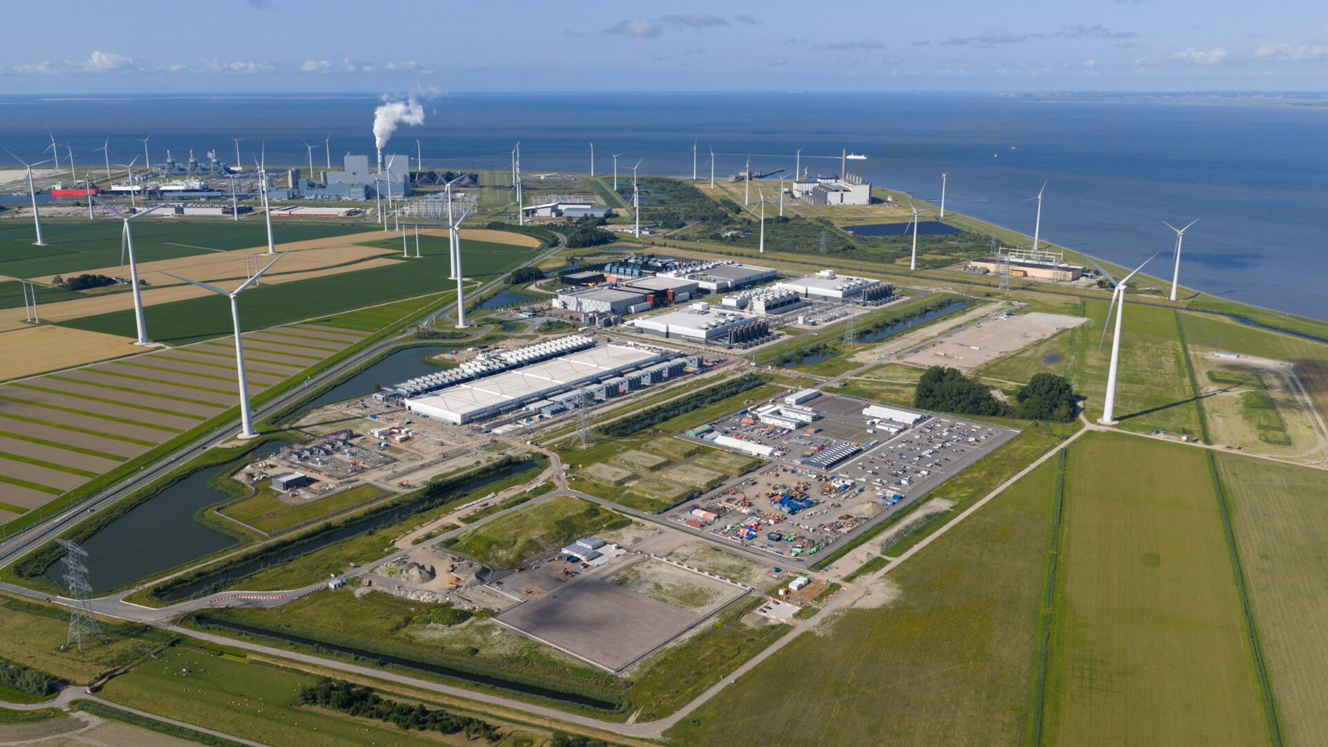
AI boom’s collision with grid reality fuels focus on amperage

The surge in artificial intelligence, coupled with the ongoing migration to the cloud, has created an appetite for energy that the existing grid was not built to sustain. Grid operators are sounding the alarm about this shift. PJM Interconnection, the largest grid operator in the United States, recently estimated a peak load growth of 32 GW by 2030. That demand is driven largely by the data center sector, which consumes energy at a much higher rate than traditional industrial or commercial developments.

This reality forces a change in site selection teams’ property evaluation. A parcel might look perfect on a standard map — flat, the right size, and zoned correctly. However, if that parcel is miles away from a substation with available capacity, or if it sits in a transmission congestion zone, it is basically useless for a hyperscale facility.

Developers can no longer afford to delay due diligence until after land acquisition. The gap between “land available” and “power available” is where projects stall and capital is lost. To mitigate this risk, teams must evaluate proximity to transmission lines and capacity constraints with the same intensity applied to environmental constraints and acreage.

Utility constraints are raising stakes and reshaping project risk

As demand outpaces supply, utilities are moving to protect the stability of the grid and the wallets of their residential customers. This shift is reshaping the financial risk profile of every data center project.

The pressure on the grid is already impacting the broader economy. Residential retail electricity prices in September rose 7.4% year-over year, reaching approximately 18 cents per kilowatt hour. As families see their bills rise, regulators and utilities are under pressure to ensure that large-load customers — specifically data centers — pay their fair share for the infrastructure upgrades they require.

This is playing out in real-time with new tariffs and strict mandates. A prime example is AEP Ohio’s recent regulatory shift. The utility now mandates that large new data center customers pay for at least 85% of their subscribed power, regardless of their actual usage.

This policy change eliminates the practice of reserving capacity “just in case.” Developers must now prove gigawatt accessibility and financial commitment early in the process. There is no room for assumptions. If a developer secures a site but cannot utilize the power they subscribed to, they face significant financial penalties. This environment demands a level of precision in site selection that can only be achieved through data-driven infrastructure intelligence.

Infrastructure Visibility is More Essential Than Ever

When energy constraints are in play, fragmented data and siloed teams create unnecessary risk. Previously, developers might have used one tool to view parcel boundaries, another to check flood zones, and a third to find utility lines based on often-outdated PDF maps.

That approach is inadequate for the current market. Developers need to visualize parcel data alongside transmission lines, substations, and fiber networks in a single environment. Integrated infrastructure visibility gives all project stakeholders a clear line of sight and transforms due diligence from reactive to strategic. Comprehensive GIS platforms enable teams to:

  • Instantly overlay utility layers: Visualize exactly where transmission lines run relative to parcel boundaries without switching between different maps.
  • Identify proximity to high-capacity utility zones: Quickly spot high-capacity utility zones and substations, filtering out sites that would require cost-prohibitive interconnection build-outs.
  • Flag potential constraints early: Identify right-of-way issues or environmental barriers that could complicate power delivery before a letter of intent is ever signed.

Seeing infrastructure in context lets teams quickly eliminate unsuitable sites and focus resources on parcels where success is probable. There’s no point in wasting time on sites that will ultimately fail the electricity test.

Centralizing intelligence enhances collaboration and accuracy

Data center site selection is a team sport involving developers, utility representatives, engineers, investors, and internal teams — all of whom need access to the same data. Disconnected stakeholders fuel miscommunication, which stalls approvals and negotiations. 

The solution, shared foundational intelligence, enables swift, confident decisions. When all collaborators can access the same data, processes move faster. For example, a developer can show an investor exactly why a specific site is worthwhile using visuals to confirm adjacent transmission lines and redundant fiber access. An engineer can spot a topographical challenge before land is purchased for substation construction, minimizing the chances of interference. 

Aligning teams around a single source of truth strengthens confidence when approaching utilities. Developers with a clear understanding of the local infrastructure demonstrate readiness and awareness, which can be differentiators in tough markets.

Latapult helps developers meet the power-first site selection standard

Energy availability has become the primary filter for data center development. Developers who prioritize land without validating infrastructure availability risk delays, unexpected costs, and stalled projects. Those who integrate intelligence early by using GIS to visualize projects, assess constraints, and emphasize coordination will come out ahead.

Latapult’s GIS platform is designed to support the “power-first” approach by funneling data — such as land boundaries, environmental constraints, and transmission and distribution frameworks — into a centralized hub for easy access. This holistic view smooths the process so all stakeholders can assess feasibility in minutes. In addition to GIS data visualization, teams count on Latapult to streamline technical workflows using a variety of reliable tools:

  • Rubber Sheet Tool: Overlay and align any map or drawing directly into the GIS interface.
  • Buildable Area Tool: Instantly evaluate usable acreage by layering key constraints with access to critical infrastructure data — including fiber routes, nearby data centers, and electric transmission — to determine site viability early on.
  • Collaboration tools: Use Shared External Bookmark Folders and Pin Groups to organize sites by project or client and securely share maps with internal teams and external stakeholders — including non-Latapult users.
  • KML Export: Share multiple project files externally in a universal, condensed format, enabling team members to easily view and utilize mapping data

The era of land-first data center development is over. You can’t afford to miscalculate a site’s power potential in this market. Tightening grid constraints and higher financial stakes have made infrastructure comprehension your most valuable asset. Latapult’s resources offer speed and accuracy to simplify power-ready site identification so teams can navigate changing industry limitations with confidence. Watch Latapult transform your site selection strategy today.