
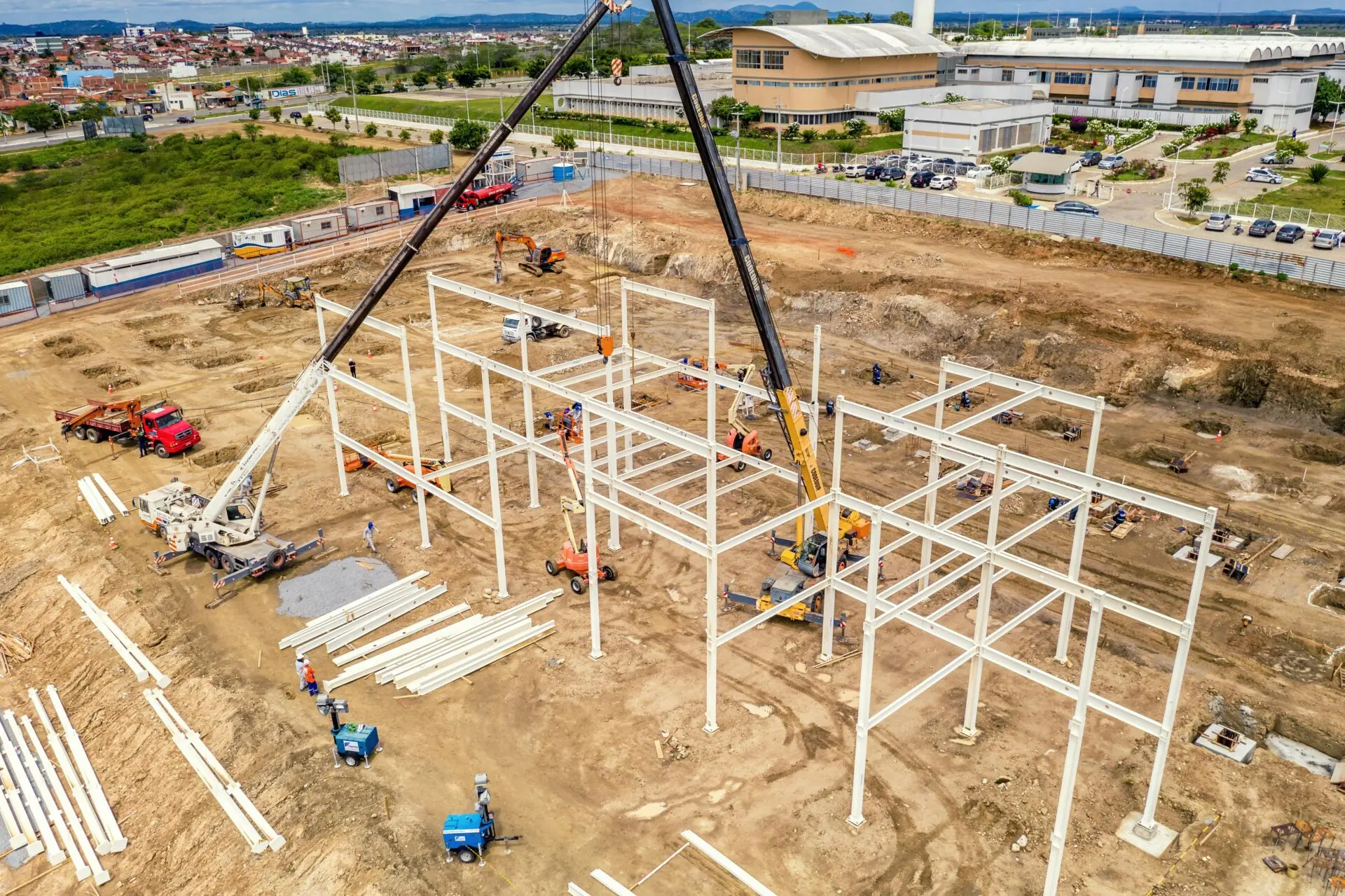
Smarter Site Selection Software Powered by GIS
Latapult is a site selection software that brings your land data, mapping tools, and due diligence workflows into one centralized platform, allowing your team to evaluate sites faster, stay organized, and make confident location decisions.


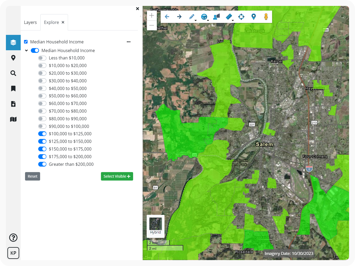
Make Faster, Smarter Location Decisions
Why Site Selection Teams Rely on Latapult

Identify viable sites faster
Search and filter large land inventories by a robust set of feasibility criteria to quickly locate and assess the best sites for your business.

Catch environmental and regulatory constraints early
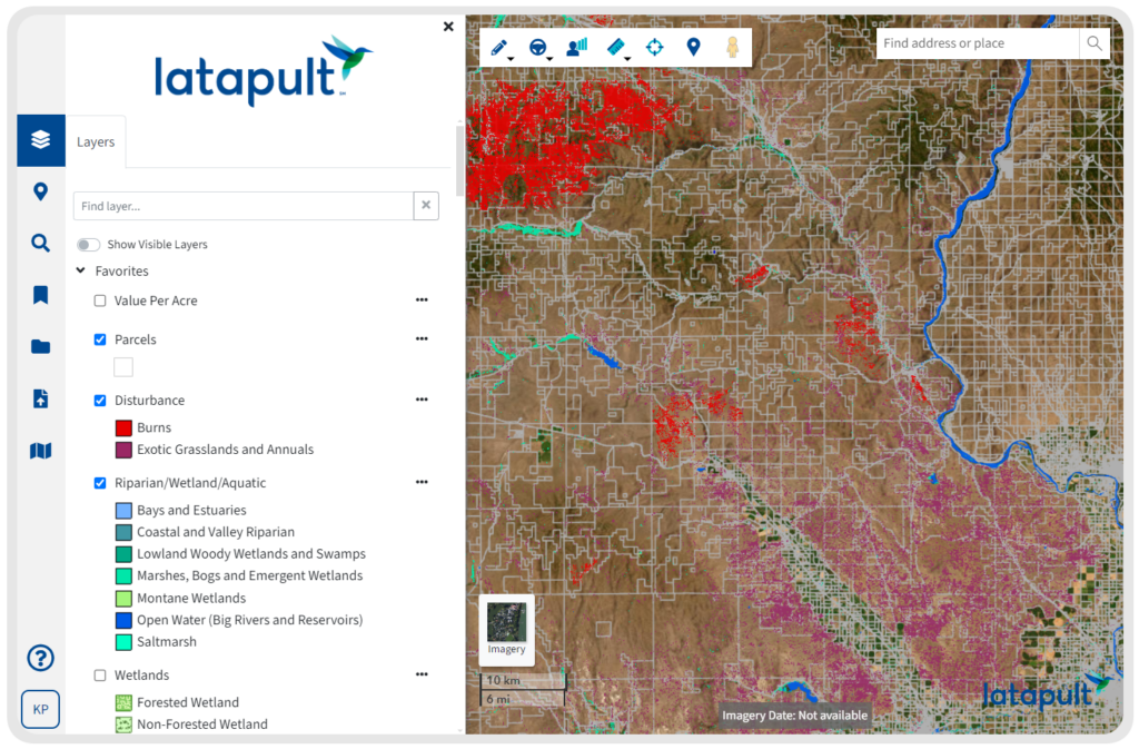
Use current GIS mapping data to uncover wetlands, and compliance considerations before they delay approvals.

Track sites across long project timelines
Centralize records, notes and evaluations to keep projects up-to-date and moving forward.

Work with your own data inside your workflows
Import internal datasets and criteria into Latapult’s site selection tool. Centralize internal data and criteria to drive efficiency and sharper decisions.

Support approvals and negotiations with visual insights
Create clear, defensible visuals for leadership, partners, and clients.
Manage Site Selection in a Single Centralized Platform
Latapult replaces fragmented records and manual mapping with centralized site selection software built to support scalable workflows.
With Latapult, you can:
- Track site status, notes, and evaluations in one system
- Share visual insights instead of static spreadsheets
- Support relocations, expansions, and approvals
- Use consistent workflows across analysts, field teams, and leadership

We work with site selectors nationwide. Put your trust in experienced hands.
-
300+
Businesses nationwide
Supported in uncovering insights that transform projects.
-
50x
Faster land research
To justify, approve, and negotiate land deals quickly and strategically.
-
$1K+
In savings a month per user
On resources, labor, and more.
-
$1M+
In GIS data
Powering environmental, demographic, geospatial, and topographic insights.
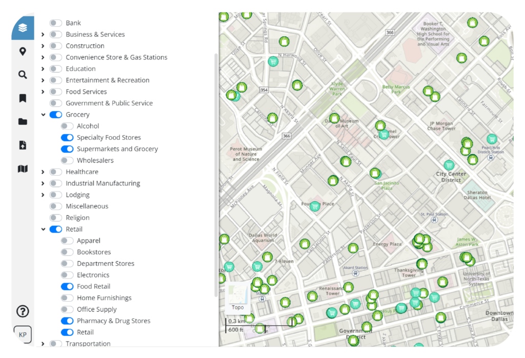
GIS Land Data Layers Built for Site Selection Teams
Reliable site decisions depend on comprehensive and up-to-date information.
Latapult provides GIS mapping data for site selection that helps evaluate:
- Parcel boundaries, size, and shape
- Utilities, including electric, natural gas, and fiber
- Zoning and land-use regulations
- Workforce and demographic indicators
- Infrastructure and logistics access
- Community and regulatory considerations
- Points of interest and access to nearby amenities
Turn Data into Sustainable Decisions with Site Selection Tools
Data doesn’t do much for you if you can’t see the full picture of your project.
Use site selection tools to:
- Visualize site feasibility with dynamic maps and overlays
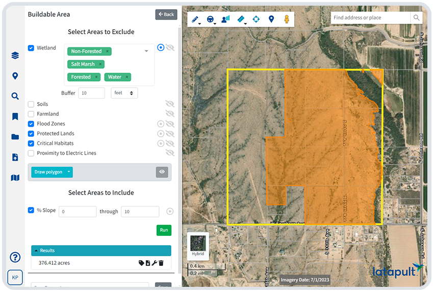
- Evaluate usable land with the Buildable Area Tool
- Compare locations using charts and graphs
- Create interactive presentations for clients and stakeholders
- Manage due diligence workflows in one place
Custom GIS Solutions for Site Selection Projects
Some site selection projects require more than an out-of-the-box GIS platform. When your evaluation process calls for deeper insight, our GIS experts can adapt Latapult to fit your data, workflows, and criteria.
- Import and manage proprietary land, scoring, and evaluation datasets
- Configure workflows to track site screening, review, and approvals
- Connect Latapult with CRMs and internal systems your team already uses
- Work directly with a GIS expert to align Latapult with your site selection
process


Frequently Asked Questions
-
How do I choose the best site selection software?
The best site selection software should help your team evaluate land accurately, manage due diligence workflows, and support confident decision-making across long project timelines. Look for a platform that combines comprehensive data, dynamic mapping tools, and workflow support in one centralized system.
Strong site selection software should allow you to:
- Search and filter large land inventories by buildability, zoning, environmental risk, and other feasibility criteria
- Visualize site data clearly with dynamic maps and evaluation tools
- Track sites, notes, and project status over time
- Work with both public and internal datasets
- Share defensible insights with leadership, clients, and partners
-
How much does site selection software cost?
The cost of site selection software varies based on the size of your team, the data you need, and the workflows you want to support. Pricing typically depends on factors such as the number of users, data access, and any customization required. Many organizations choose flexible platforms that allow them to scale access and data layers over time to match project needs and budgets.
-
What is site selection software?
Site selection software is a digital platform that helps teams evaluate land, analyze feasibility, and manage due diligence workflows. It centralizes land data, mapping tools, and project tracking so teams can compare locations, identify risks, and make informed decisions about relocations, expansions, and new developments.
-
How accurate is Latapult’s property data?
Latapult sources its parcel and market data from verified public and commercial providers, updating it regularly to ensure accuracy. This includes ownership records, zoning codes, environmental layers, and market indicators. Accurate data is essential for developers to make informed site selection and planning decisions.
-
What are the benefits of using site selection software?
Site selection software helps teams reduce risk, save time, and improve decision quality by centralizing data and workflows. Key benefits include faster land screening, clearer visibility into feasibility constraints, better collaboration across teams, and stronger support for approvals, negotiations, and long-term planning.