Forgo Tabs for a Smarter, Affordable Land Use Analysis Approach
April 1, 2025
Analyzing a single piece of land shouldn’t mean toggling between 10 different tabs to gather information. This is a challenge a prospective client brought up during a conversation, and it’s spot-on. This particular brand of frustration isn’t new among land research teams, and the client certainly isn’t the only one feeling fed up.
We often hear that land evaluators, acquisition teams, and developers are tired of juggling multiple tabs to complete land research or are tired of using a costly software stack with limited or incomplete data.
One developer, who is focused on high-density infill projects, described the struggle accurately when chatting with our team, saying, “I have a window on my computer that has about eight different tabs. It’s all counties in the MSA, all other municipalities, and the majority of their zoning ordinances. I’m always flipping through all of these tabs trying to determine land specifics, like what jurisdiction is it? What’s the acreage? How much of it’s high? How much of it’s wet? Just seeking all of the information I can get through the various sources — it’s cumbersome.”
Seeing challenges like this pop up again and again inspired our development team to create a sophisticated approach to land analysis that addresses these long-standing problems so Latapult users can make smarter, more informed decisions.
Latapult is designed to streamline workflows, deliver reliable data, and enhance project outcomes. It’s time to eliminate the daily hassles of land research with a GIS software that is easy to use and readily accessible.
FRAGMENTED DATA SOURCES HAVE MANY HIDDEN COSTS
Access to accurate and complete data is essential, yet many workflows rely on piecing together information from multiple sources like county websites, government GIS portals, and environmental databases. Here’s where it gets problematic:
- Outdated or incomplete datasets leave analysts guessing about property ownership, access to utilities, and environmental risks.
- Switching between platforms is inefficient and increases room for error.
- Teams often overpay for siloed and incomplete data, requiring additional subscriptions or tools to supplement missing pieces.
These numerous obstacles result in wasted time, high operational costs, and, most critically, uninformed decisions — all of which could jeopardize the success of projects and harm an organization’s bottom line. Incomplete or inaccessible data complicates the due diligence process, leading to poor investments as well as countless delays as analysts spend extra hours aggregating data. Manual processes and extra software subscriptions inflate company expenses, which is tough to swallow, especially if amplified by missed opportunities.
TAKE A SMARTER APPROACH TO LAND ANALYSIS
Consolidating all critical land information onto a single, efficient platform streamlines land analysis for professionals, who stand to benefit from the all-in-one software offered by Latapult. Latatpult addresses frequently encountered challenges by combining comprehensive data, custom workflows, and reliable insights and enables analysts to work smarter, not harder. Here’s how:
1. Unified Data Platform
Integrated, up-to-date, verified data layers create a single point of access for:
- Ownership and tax assessor information
- Environmental hazard data
- Distance to amenities
- Transportation networks and demographics
With over 250 curated data layers built using ESRI and CoreLogic, Latapult’s platform provides a solid database that eliminates the need to balance multiple platforms. All the information needed is readily available.
2. Workflows for Individuals or Teams
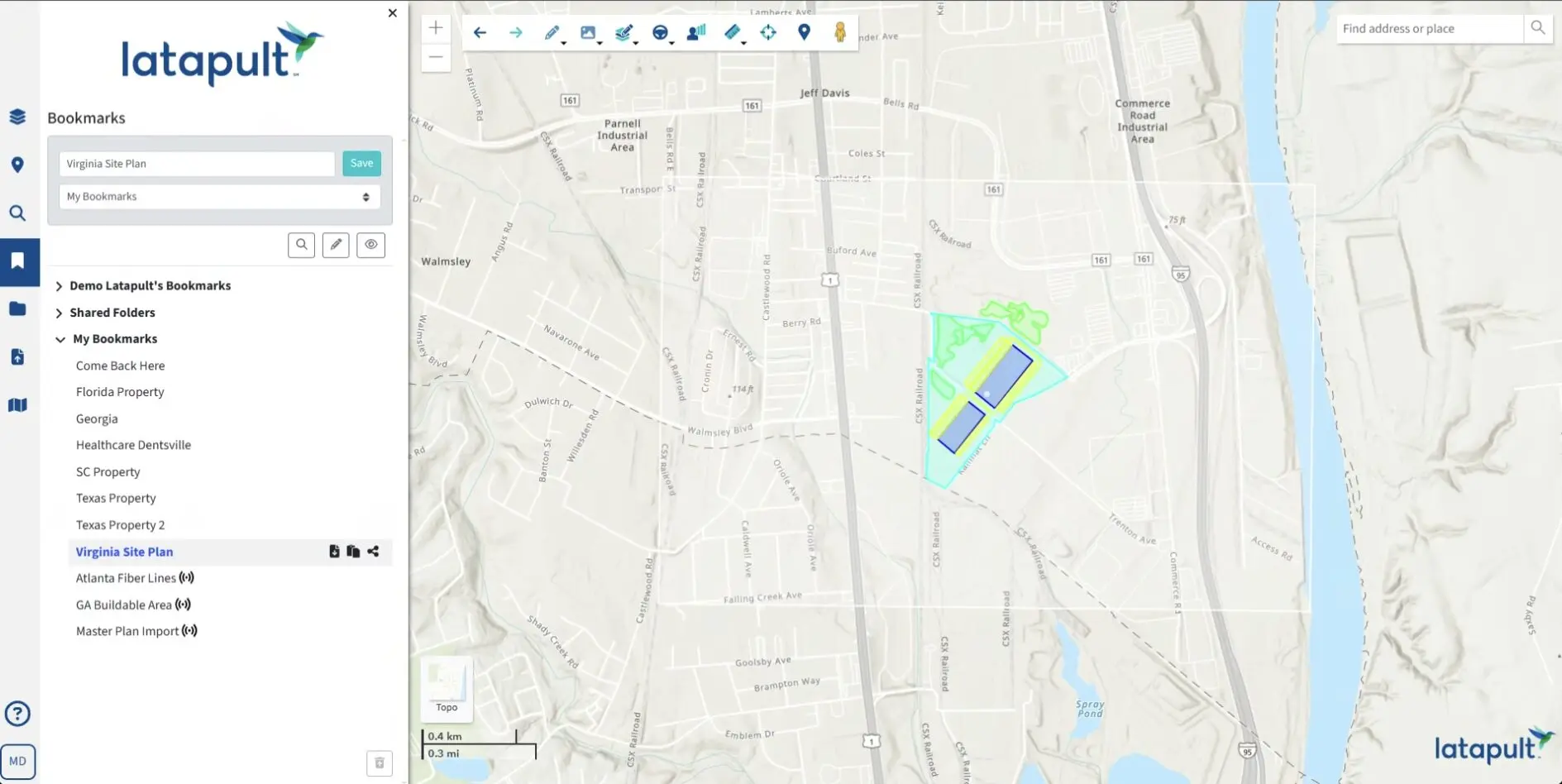
One size does not fit all, so GIS platforms must offer tools that adapt to individual workflows and team needs. Collaborative features, such as shared data folders or custom bookmarks, streamline teamwork and break down departmental silos. Teams can enhance their workflows using Latapult’s interactive tools and collaborative features, ensuring communication is seamless across projects and no detail is spared.
3. Customizable Software
Every analysis is unique, and professionals often bring their own datasets into the equation. Configurable GIS software allows analysts to incorporate external data into one seamless view that is tailored to their needs. The integration of third-party and proprietary data sources through Latapult’s system reduces the need for multiple screens and software subscriptions while providing a comprehensive picture for evaluation. Contact our team to learn how Latapult can be customized for your data.
COMPREHENSIVE GIS SOFTWARE SAVES MONEY AND TIME
The value of a comprehensive GIS solution extends far beyond convenience. Businesses adopting smarter tools can realize tangible benefits, including time savings, cost efficiency, data reliability, enhanced collaboration, and improved ROI.
Spending more time making decisions and less time hunting for information certainly has its perks. For example, Latapult clients who consolidated workflows have seen reduced project timelines by 30%. They also saved money by eliminating the need for redundant software licenses in favor of a single, comprehensive subscription.
Providing access to accurate, real-time data reduces pitfalls, improves confidence in project decisions and eases workloads, often strengthening productivity and morale. Satisfied teams united under one digital roof by innovative tools designed for communication and data sharing ultimately improve ROI and outcomes, boost project success rates, and support smart investments.
CHART A NEW COURSE NOW FOR BETTER RESULTS TOMORROW
Why waste another day juggling tabs or overspending on inadequate tools? Ditch the inefficiencies, simplify your workflows, and confidently take your operation to the next level.
Here’s how to get started:
- Existing Clients: Discover the power of Latapult Custom with advanced project-tracking layers and software integrations to manage all your data in one place.
- New to Latapult? Register for a live demo to explore the GIS platform conveniently and affordably transforming land analysis for professionals worldwide.


