GIS Fuels Economic Growth with Data and Insights to Empower Development Teams
October 29, 2025
Economic development teams face constant pressure to attract new business, secure investments, and support sustainable community growth through the expansion of existing resources. To stay competitive, these teams need tools that are more effective than traditional datasets. Their important work demands features that transform data into actionable insights, revealing quality-of-life factors that matter to site selectors, such as community assets and infrastructure networks.
Latapult’s GIS platform delivers the information and tools developers rely on to drive economic growth through informed decisions and optimized planning. From analyzing development-ready sites to documenting infrastructure and supporting strategic planning, GIS lets teams compete for investment and future-proof their projects.
Key Use Cases and Features for Economic Development Teams
Economic developers must showcase their community’s strengths to potential business owners, operators, and investors. The case they build is only as strong as the story they can tell with their data. It’s not just about having numbers — it’s about visualizing them in a way that reveals opportunity and momentum.
Latapult makes that possible by allowing users to layer multiple data sources in one space, helping teams illustrate the full picture of their development plans. Clear, informative maps and geospatial insights make a community’s value more apparent to site selectors and stakeholders. Visually showcasing a project’s appeal supports smarter decision-making and long-term growth strategies.
Infrastructure readiness and quality-of-life mapping
Demonstrating a proposed project location’s value to stakeholders seeking reliable, steady-growth areas becomes far more straightforward with the right tools. GIS enables users to visualize population insights — including education levels, job industries, and commuting patterns — and showcase factors that support a good standard of living, like housing, healthcare, and recreational amenities.
Latapult’s platform offers a distinct advantage, allowing teams to create interesting, data-heavy presentations that resonate with site selectors and decision makers. Mapping these critical elements helps to paint a holistic picture of a community and offers compelling evidence of its potential for investment and growth.
Comprehensive site evaluation
During the site selection and evaluation process of an economic development project, GIS tools give users powerful analytical capabilities. Economic developers can instantly assess environmental constraints, which is crucial for early-stage due diligence and minimizing risk.
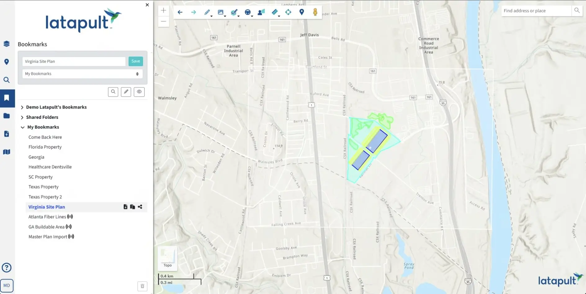
Latapult’s Buildable Area Tool ups the ante even more by letting teams visualize and determine actual buildability and analyze parcels against various environmental or topographical constraints, such as flood zones and wetlands. Our solution also imports layouts from engineers so economic developers can display site plans during presentations or share them with other departments.
Latapult’s interactive mapping tools solve this by transforming complex data into clear, visual, and accessible insights. Information such as flood plains, soil classifications, and utility proximity can be layered onto a single map, making it easy for anyone to grasp the opportunities and constraints of a particular site. Streamlined communication and increased transparency lead to:
Detailed infrastructure asset mapping
Infrastructure is a critical component in any site selection process. To build a convincing case for development-ready sites, teams need top-tier technology like Latapult’s to map and analyze infrastructure components — including utilities, transportation networks, rail lines and broadband coverage — and identify gaps and opportunities that make land more attractive to investors.
Latapult’s platform provides detailed visibility into electric, natural gas, fiber, and rail networks, which are all major factors in assessing a site’s development cost and viability. Communities with available data can also import local water and sewer network information to generate a more complete picture of a site’s readiness. Access to existing utilities, along with rail connectivity, is often the biggest determinant in whether a site is truly shovel-ready and positioned for economic growth.
Conducting comprehensive research in these areas gives stakeholders a clear, data-backed view of a location’s qualifications and ensures all parties have the insights needed to make confident, informed decisions.
Scenario planning for long-term growth
Sustainable growth requires forward-thinking strategies. To help future-proof economic development, Latapult’s access to over 250 data layers makes it easy to create and assess sophisticated plans that take utility capacity, zoning impacts, and environmental constraints into consideration.
Modeling various scenarios and evaluating factors like flood zones, natural disasters, and regulatory challenges further mitigates risk, which is a bonus when something as impactful as an economic development project is on the line. These initiatives create jobs, attract investment, foster growth, and elevate a community’s overall standard of living, so it’s hard to do too much due diligence when determining whether a site is the right fit. When all stakeholders and communities themselves have reliable intelligence, they can plan for the future with greater confidence, so growth is more strategic and sustainable.
The Biggest Competitive Edge Stems from the Support of a Trustworthy Partner
Latapult’s GIS platform gives economic developers a distinct advantage by consolidating essential data, accelerating land use analysis, and producing compelling visual presentations. The support teams receive is invaluable and includes:
- Tools to streamline collaboration and align stakeholders, reducing miscommunication and delays.
- The ability to illustrate and analyze critical elements that influence site selection and investment decisions.
- Access to over 250 data layers, offering unparalleled insights across various industries.
Having a reliable partner ensures that economic development teams have the resources needed to succeed in a landscape that’s growing crowded and more competitive daily.
Redefine Your Economic Development Strategy
Economic development teams need innovative resources to stay competitive in today’s fast-paced market. Latapult’s GIS platform equips teams with the data, features, and insights required to attract new business, obtain investments, and expand responsibly. From mapping development-ready sites to future-proofing growth strategies, Latapult is the go-to solution for economic developers committed to driving real-world impact.
Experience firsthand how Latapult can redefine your economic development workflows. Schedule a demo today and discover the power of GIS for driving growth.


