Land Acquisition: How-To Guide for Getting the Best Return from Your Next Project
July 19, 2024
In most industries, time is money. That philosophy holds true for land acquisition, too. We’ve had countless customers come to us, working with tight deadlines in search of suitable land for their next project.
So, are you looking to make a return-worthy investment by acquiring new land? You don’t need to spend weeks researching properties through disparate data or time-consuming processes. Follow these steps to find your next property and gain your investors’ buy-in and, ultimately, their trust.
Step 1: Find a GIS Technology Provider for Land Acquisition
The most important consideration to make your project a success is to find a GIS technology provider that has the property details and features you need to make the land acquisition process easy. With Latapult, you can create and perform land analysis workflows and gain fast access to geographic data, built-in analysis tools, and more…all in one easy-to-use interface. Having Latapult’s web-based mapping platform at your fingertips can help make the next few steps a breeze.
Step 2: Find and Evaluate Properties Quickly and Easily
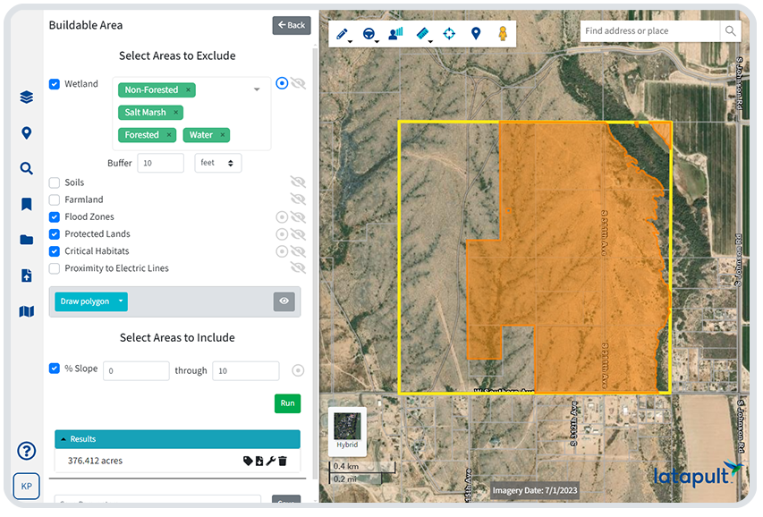
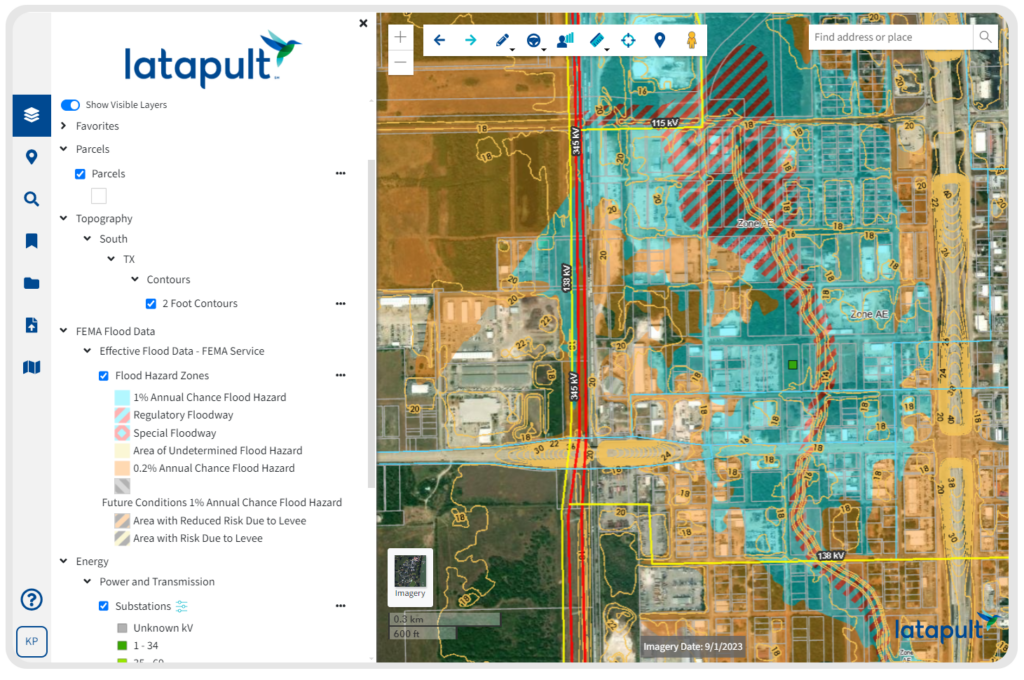
Did your employer or investor give you specific instructions and criteria they’re looking for? Instead of cycling through various sources of land data, with Latapult, you can quickly search for properties that match your desired land attributes. We can even help you weed out unfit options as you explore properties for criteria such as wetlands, soils, elevation, FEMA and more.
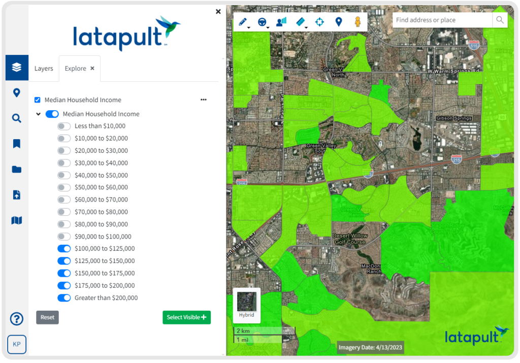
Step 3: Analyze Demographics and Property Proximity with Visual Data
After your initial search, you may have found several properties that fit your criteria. Sometimes you already have a list of properties from your employer. But with what you know about your end customer, GIS technology can help narrow your options even further. Through U.S. census data, Latapult creates demographic reports so you can get a better idea of the people in your area. You’ll also have the option to visualize data to see what’s within driving distance from a property. For example, find which local amenities are within close proximity to your possible developments and compare which site has more potential. Once you’ve collected the data you need, use Latapult to create maps or interactive charts to better visualize all of the data and properties you’ve collected. For instance, you can use maps and charts to better compare your property options based on sales prices, land acreage, market land value and more.
Step 4: Manage Data and Visibility for Investors
Think you’ve found the best property to get the greatest return on investment? It’s time to gain your investors’ buy in! Before presenting your plan, you’ll want to make sure your data is organized and easily digestible. Through Latapult, you can create and organize pins in order to get your ideas on the map. Once your ideas are outlined, features like bookmarks and graphics capabilities allow you to build presentations or printed maps for reports to help your investor better visualize the data and property you found. After all, 40% of people respond more positively to visual information than plain text.
With Latapult, land acquisition management has never been easier. With our easy-to-use platform, you can quickly find properties across the U.S. in one centralized data source.
Go into your next investor meeting with confidence knowing you’ve found the right properties using GIS technology. Click here to get started with Latapult’s land acquisition software.