How Land Developers Can Operate Businesses Remotely and Virtually
July 16, 2022
How Proptech Helps Developers with Virtual Land Acquisition
It’s no secret that COVID-19 had businesses across industries scrambling to move to remote work; However, in many ways, land evaluation and development professionals were able to adapt quickly, even picking up traction in recent months.
How was this sector able to operate its business virtually and nimbly? Read on to learn about the technology that has helped land developers quickly solve challenges remotely, efficiently and effectively to set themselves up for success.
Proptech Supports the Future of Land Development
In many ways, the pandemic accelerated the future of the industry – changing the way we shop, changing the way businesses fulfill demand and changing the way industries respond to that demand in a matter of days. Developers were not exempt.
Just as office workers flocked to Zoom, land developers also found themselves leaning more heavily on virtual options to continue running their businesses smoothly. Already adopted by developers looking for accuracy, agility and efficiency, proptech fueled sound investments even when professionals weren’t able to physically visit sites. During COVID, they were able to conduct virtual site visits and land analysis through GIS technology – ushering in the future of the land development industry.
Beyond site visits, GIS-based proptech solutions are fueling smarter land decisions by:
- Improving the research and strategy phase of land acquisition with deeper, more easily accessible data layers
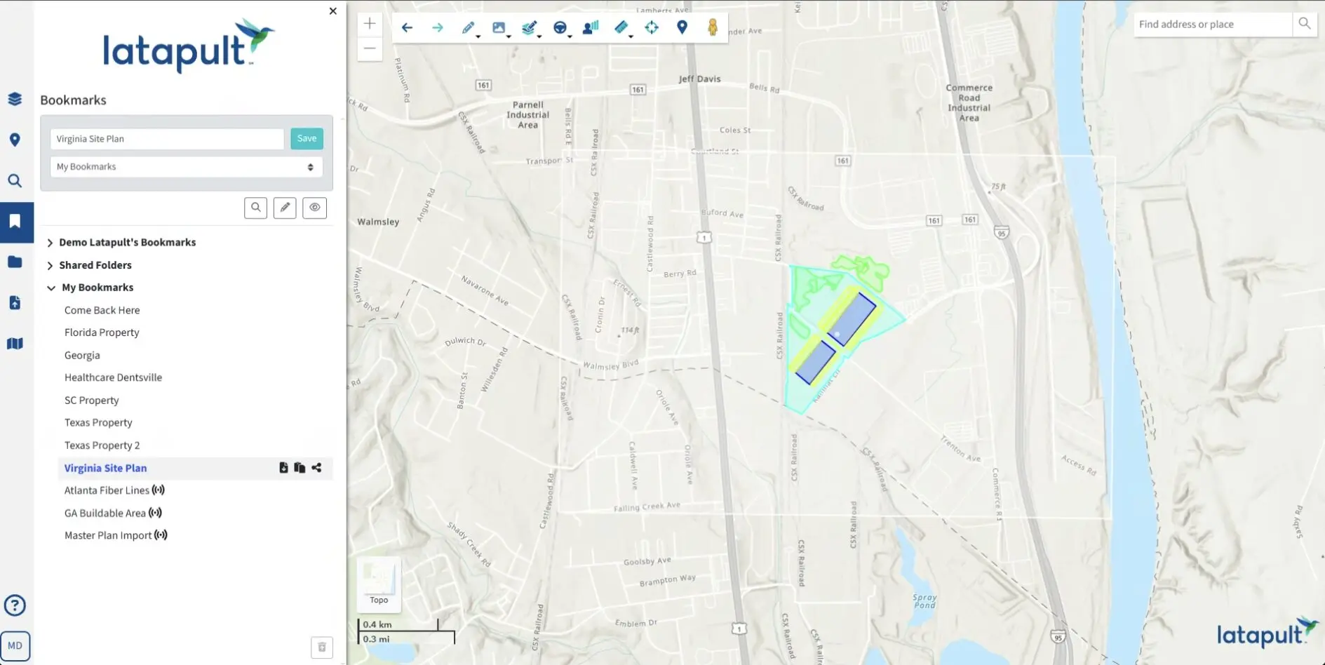
- Tracking and sourcing prospective deals by adding custom pin layers to maps
- Easily determining the amount of developable acreage within a property, saving time and money on the evaluation process
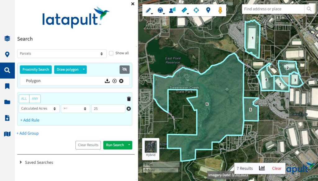
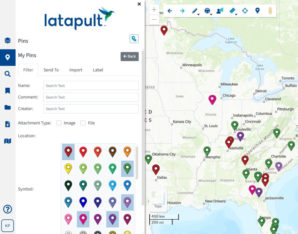
With GIS technology, developers have access to land data at their fingertips.
Proptech Supports the Future of Land Development
Smart land development decisions should be driven by precise parcel and land data. Unfortunately, such information is often fragmented and only available via various, often outdated, resources. In the past, mapping accurate data was expensive and time-consuming. But now, investors can use digital sources and cloud-based solutions for land data and maps to make smarter decisions/ Fueled in part by public health and travel restrictions, more companies are recognizing the unquestionable value of the cloud.
The future of the real estate and development industry – and all industries – is mobile and agile. With Latapult, land developers can perform land analysis workflows with fast access to geographic data and built-in analysis tools, all in one easy-to-use interface. Our cost-friendly GIS technology gives land professionals the power to manage projects from any place and at any time on a tablet, smartphone, or computer.
Want an easier way to adjust to the “new norm” of business in land development? Click here to learn more about Latapult’s proptech for smart land acquisition decisions.


