Tune-Up Tuesdays: 3 Ways You Can Improve Internal Communication with Latapult
January 9, 2019
Communication across departments and offices can be a challenge for stakeholders involved in land use planning, land acquisition, and property analysis. When your primary business involves a valuable, tangible piece of the earth or a structure that is constantly transforming and responding to internal and external forces, the speed and accuracy with which you communicate with your peers is indicative of a business’s bottom line. An added complexity for those in this field is that the medium in which we work is often not something that can be captured by an email or a photograph. Land is all around us, and GIS mapping is a dynamic way to capture the many factors that must be considered in its development.
Latapult is a web-based, on-demand land data visualization and mapping software that allows users to view and analyze data in real time in one centralized hub. Using Latapult, especially within a company, can be extremely beneficial for sharing information and preparing for clients on one platform. Latapult’s property and land data presentation and querying capabilities are only bolstered by its comprehensive communication tools. Here are three ways Latapult can improve interdepartmental communication and, in turn, help grow your business.
Real-Time Notes
Latapult allows you to add notes that colleagues can revisit throughout the life of a project. On any platform, you can upload photos from the job site and attach vital documents, which can all be shared seamlessly across an organization. Pins can be added anywhere on the spatial interface to call out points of interest to visit later and/or leave comments for your colleagues.
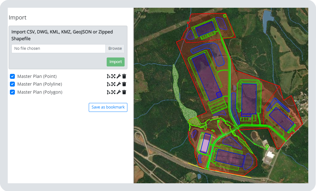
At Latapult, we understand that there are many tools in a land stakeholder’s tool belt. For this reason, we are compatible with file types from different planning and GIS software, including CSV, DWG, KML, KMZ, or zipped Shapefiles. If you have a set of plans or drawings unique to a project, upload them to view in comparison with existing layers.
Export and Share Data
Latapult’s export capabilities allow users to share findings outside the application for presentations and reports. Export geometry in a KML or table search results in a CSV file after querying for specific features. These items can be further manipulated in supporting programs. Users often find themselves wanting to take the rich analysis they’ve performed in Latapult outside the application. PDF maps can be downloaded and printed directly from Latapult to share among colleagues or in front of clients. Our map creation includes layers and customizable graphic tools to help further convey your message.
Searching
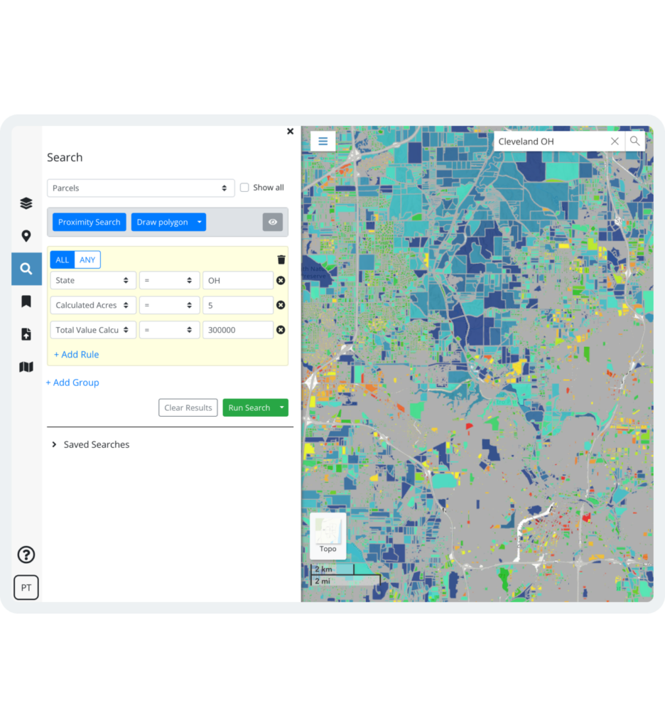
Traditional mapping programs in the workplace are time-consuming and onerous to operate. Sharing this information with a client or colleague who is unfamiliar can be incredibly stressful – especially when highlighting a specific location amidst data layers. Latapult alleviates this hurdle with our Search feature. You can perform a property search with ease by address or place name, or search for a specific property by attributes, such as owner, acreage, zoning, or location details. Using the Search, you can pull up a location of interest on the screen while keeping relative data layers, notes, and graphics intact.
Latapult was developed by Geographic Information (GIS) analysts who understand the necessity to automate and streamline a workload. Our intuitive, built-in communication tools are reflective of just that. Whether you are a land broker working on a team, a designer at a consulting firm, or a board member for your neighborhood property owners’ association, Latapult can help you tell the story of your land. Start your free trial with Latapult today to begin communicating effectively internally and achieving success externally.


