
Advanced Land Intelligence
Latapult Regions Plus
Move beyond static maps and disconnected workflows. Latapult Regions Plus helps organizations turn land intelligence into action with connected datasets, editable GIS layers, project-tracking tools, and organization-wide workflows, so land intelligence becomes part of the workflow, not another thing to manage.
The Work Doesn't Stop After Discovery
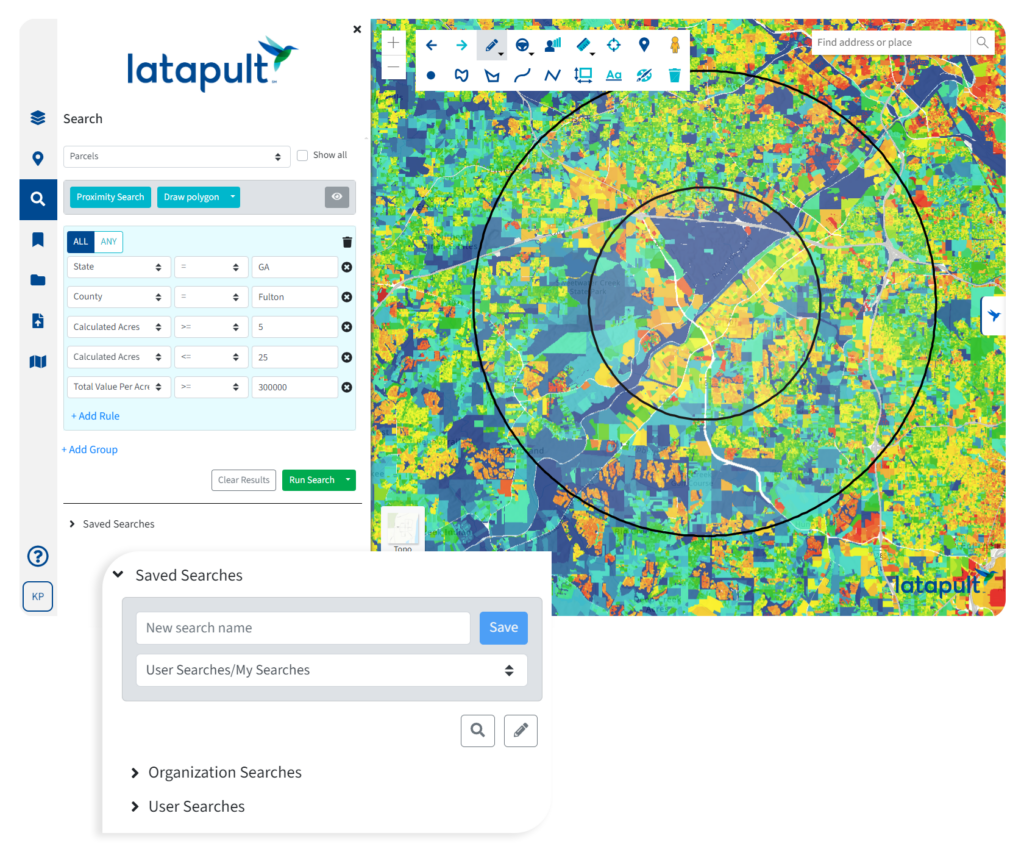
The best land decisions happen when everyone is working from the same information. Regions Plus connects teams, datasets, and workflows in a shared operational environment, helping organizations stay aligned as projects grow more complex.
Standardize workflows
Replace disconnected processes with shared GIS workflows that help teams work consistently across projects, markets, and departments.

Track what matters
Monitor project activity, manage development pipelines, and maintain visibility into the information driving land decisions.
Keep data connected
Bring together editable GIS layers, shared datasets, and external live web services to create a more complete operational view of your land portfolio.

Align teams
Give stakeholders access to the same information to help acquisition, development, planning, and GIS teams stay coordinated as projects evolve.
Connect the dots behind every opportunity.
Regions Plus includes all the advanced capabilities of Latapult Regions, including Property Intelligence, Smart Land Searches, Site Feasibility Analysis, GIS mapping, shared workflows, and access to 250+ GIS datasets, and takes them to the next level. It also adds advanced capabilities designed to support connected land intelligence across teams, projects, and workflows.
Create Shared Editable Data Layers
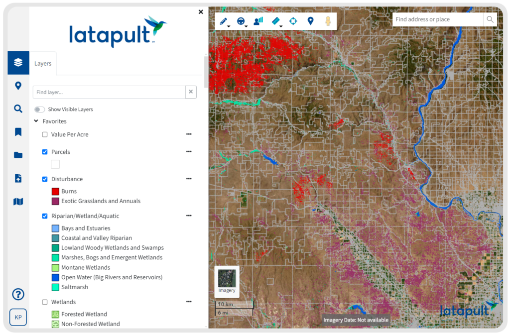
Move beyond static maps with editable GIS layers that allow teams to capture, update, and manage information as projects evolve.
Expanded GIS Workflows
Support more sophisticated operational processes with GIS workflows designed to standardize how information is collected, managed, and shared across teams.

Advanced Symbology & Styling
Create maps that communicate information more clearly with enhanced visualization, styling, and customization options.

Enhanced Data Management
Keep datasets organized, up to date, and accessible with tools that support shared operational workflows and long-term land management.
However you work, Latapult works for you
Acquisition teams need visibility. Development teams need coordination. Evaluation teams need confidence in the data behind every recommendation. Regions Plus brings it all together in a connected operational environment built for the way land teams actually work.
Land Acquisition
Identifying opportunities is only the beginning. Regions Plus helps acquisition teams track activity, manage pipelines, and keep stakeholders aligned as opportunities move from research to action.

Land Development
Projects move faster when everyone is working from the same information. Regions Plus helps development teams coordinate workflows, manage shared datasets, and maintain visibility across every stage of a project.

Land Evaluation
Recommendations shouldn’t live in a report and disappear. Regions Plus helps evaluation teams keep data, insights, and project information connected as sites move through the development lifecycle.
The difference is how the data comes together
Parcel data exists in a lot of places; Latapult connects it in a way that gets you the answers you need, exactly how you need them.
|
Latapult
|
Other Tools
|
|
|---|---|---|
| Shared editable GIS layers across teams | ||
| Project tracking connected to land data | ||
| Live GIS services and connected datasets | ||
| Standardized workflows across projects | ||
| Current information available to every stakeholder | ||
| Land intelligence embedded in daily operations |
Need more flexibility? Meet Latapult Custom Enterprise.
Every organization manages land differently. Latapult Custom extends beyond configurable workflows to deliver custom GIS applications, dedicated infrastructure, specialized integrations, and tailored data management solutions built specifically for your teams and processes.
- Custom GIS applications and workflows
- Dedicated enterprise GIS architecture
- Configurable data pipelines and automation
- Custom layer creation and management
- Spatial document management
- Dedicated GIS experts



Frequently Asked Questions
-
How do I get multiple land teams working from the same GIS data?
Regions Plus helps acquisition, development, planning, and evaluation teams work from shared GIS datasets within a single operational environment. By centralizing information and workflows, teams can collaborate more effectively while maintaining a consistent view of project and land data.
-
What capabilities are included in Regions Plus that aren’t available in Regions?
Regions Plus builds on the land discovery and intelligence capabilities available in Regions by adding editable GIS layers, shared operational datasets, project-tracking tools, connected data services, and advanced workflow management for organization-wide land operations.
-
Why would I upgrade from Regions to Regions Plus?
Regions helps teams discover, research, and evaluate land opportunities. Regions Plus extends those capabilities with operational tools that help organizations manage projects, standardize workflows, maintain shared datasets, and keep information connected long after the initial analysis is complete.
-
How do I track land acquisition and development projects in one place?
Regions Plus combines project-tracking tools, shared datasets, and GIS workflows into a connected platform. Teams can manage opportunities, monitor project progress, and keep critical land information tied directly to active projects.
-
How do I standardize GIS workflows across teams?
Regions Plus enables organizations to create shared workflows, editable GIS layers, and standardized processes that can be used consistently across departments, markets, and project types. This helps reduce inconsistencies and improve operational efficiency.
-
What’s the difference between GIS mapping and operational land intelligence?
GIS mapping helps organizations visualize and analyze land data. Operational land intelligence extends those capabilities by connecting data, projects, workflows, and stakeholders within a shared environment that supports ongoing decision-making and land management activities.
-
What is a connected land intelligence platform?
A connected land intelligence platform brings together land data, workflows, projects, and stakeholders in a single environment. Regions Plus helps organizations move beyond static maps by keeping information connected to the decisions, teams, and projects it supports.
-
Can Regions Plus support development pipelines and project tracking?
Yes. Regions Plus is designed to support development pipelines, project tracking, and ongoing land operations. Teams can track opportunities, manage project status, and maintain visibility across active initiatives within a shared operational environment.
-
How does Regions Plus help teams manage living datasets?
Regions Plus allows organizations to create editable GIS layers and shared operational datasets that evolve alongside projects. Instead of creating static maps that quickly become outdated, teams can maintain information that stays current as conditions, projects, and priorities change.
-
How do I create a single source of truth for land data?
Regions Plus helps organizations create a single source of truth through shared GIS datasets, editable GIS layers, project tracking, and connected operational workflows. Teams can work from the same information across projects, departments, and markets while reducing reliance on disconnected files and systems.
